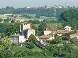
Saint-Amant-de-Montmoreau
| Saint-Amant-de-Montmoreau | |
|---|---|
 | |
 Saint-Amant-de-Montmoreau Location within Nouvelle-Aquitaine region  Saint-Amant-de-Montmoreau | |
| Coordinates: 45°23′46″N 0°09′27″E / 45.3961°N 0.1575°ECoordinates: 45°23′46″N 0°09′27″E / 45.3961°N 0.1575°E | |
| Country | France |
| Region | Nouvelle-Aquitaine |
| Department | Charente |
| Arrondissement | Angoulême |
| Canton | Tude-et-Lavalette |
| Area1 | 27.2 km2 (10.5 sq mi) |
| Population (2008)2 | 674 |
| • Density | 25/km2 (64/sq mi) |
| Time zone | UTC+1 (CET) |
| • Summer (DST) | UTC+2 (CEST) |
| INSEE/Postal code | 16294 /16190 |
| Elevation |
70–191 m (230–627 ft) (avg. 140 m or 460 ft) |
|
1 French Land Register data, which excludes lakes, ponds, glaciers > 1 km2 (0.386 sq mi or 247 acres) and river estuaries. 2 Population without double counting: residents of multiple communes (e.g., students and military personnel) only counted once. | |
Saint-Amant-de-Montmoreau (before 2013: Saint-Amant)[1] is a former commune in the Charente department in southwestern France. On 1 January 2017, it was merged into the new commune Montmoreau.[2]
Population
| Historical population | ||
|---|---|---|
| Year | Pop. | ±% |
| 1793 | 1,089 | — |
| 1800 | 1,046 | −3.9% |
| 1806 | 974 | −6.9% |
| 1821 | 1,179 | +21.0% |
| 1831 | 1,151 | −2.4% |
| 1841 | 1,050 | −8.8% |
| 1846 | 1,098 | +4.6% |
| 1851 | 1,106 | +0.7% |
| 1856 | 1,065 | −3.7% |
| 1861 | 993 | −6.8% |
| 1866 | 978 | −1.5% |
| 1872 | 975 | −0.3% |
| 1876 | 971 | −0.4% |
| 1881 | 946 | −2.6% |
| 1886 | 892 | −5.7% |
| 1891 | 855 | −4.1% |
| 1896 | 872 | +2.0% |
| 1901 | 872 | +0.0% |
| 1906 | 890 | +2.1% |
| 1911 | 860 | −3.4% |
| 1921 | 795 | −7.6% |
| 1926 | 782 | −1.6% |
| 1931 | 813 | +4.0% |
| 1936 | 776 | −4.6% |
| 1946 | 705 | −9.1% |
| 1954 | 693 | −1.7% |
| 1962 | 663 | −4.3% |
| 1968 | 631 | −4.8% |
| 1975 | 603 | −4.4% |
| 1982 | 660 | +9.5% |
| 1990 | 665 | +0.8% |
| 1999 | 646 | −2.9% |
| 2008 | 674 | +4.3% |
See also
References
- ↑ Décret n° 2013-986 5 November 2013 (in French)
- ↑ Arrêté préfectoral 29 June 2016 (in French)
| Wikimedia Commons has media related to Saint-Amant-de-Montmoreau. |
This article is issued from
Wikipedia.
The text is licensed under Creative Commons - Attribution - Sharealike.
Additional terms may apply for the media files.