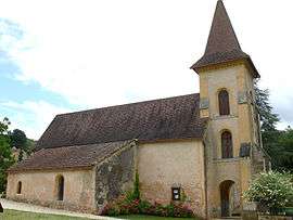
Saint-Amand-de-Belvès
| Saint-Amand-de-Belvès | |
|---|---|
 | |
 Saint-Amand-de-Belvès Location within Nouvelle-Aquitaine region  Saint-Amand-de-Belvès | |
| Coordinates: 44°45′44″N 1°02′18″E / 44.7622°N 1.0383°ECoordinates: 44°45′44″N 1°02′18″E / 44.7622°N 1.0383°E | |
| Country | France |
| Region | Nouvelle-Aquitaine |
| Department | Dordogne |
| Arrondissement | Sarlat-la-Canéda |
| Canton | Belvès |
| Intercommunality | Entre Nauze et Bessède |
| Government | |
| • Mayor (2008–2014) | Brigitte Pistolozzi |
| Area1 | 7.06 km2 (2.73 sq mi) |
| Population (2008)2 | 88 |
| • Density | 12/km2 (32/sq mi) |
| Time zone | UTC+1 (CET) |
| • Summer (DST) | UTC+2 (CEST) |
| INSEE/Postal code | 24363 /24170 |
| Elevation |
103–257 m (338–843 ft) (avg. 130 m or 430 ft) |
|
1 French Land Register data, which excludes lakes, ponds, glaciers > 1 km2 (0.386 sq mi or 247 acres) and river estuaries. 2 Population without double counting: residents of multiple communes (e.g., students and military personnel) only counted once. | |
Saint-Amand-de-Belvès (Languedocien: Sench Amand de Belvés) is a former commune in the Dordogne department in southwestern France. On 1 January 2016, it was merged into the new commune Pays-de-Belvès.[1]
Population
| Historical population | ||
|---|---|---|
| Year | Pop. | ±% |
| 1962 | 139 | — |
| 1968 | 123 | −11.5% |
| 1975 | 104 | −15.4% |
| 1982 | 86 | −17.3% |
| 1990 | 104 | +20.9% |
| 1999 | 100 | −3.8% |
| 2008 | 88 | −12.0% |
See also
References
- ↑ Arrêté préfectoral 21 December 2015 (in French)
| Wikimedia Commons has media related to Saint-Amand-de-Belvès. |
This article is issued from
Wikipedia.
The text is licensed under Creative Commons - Attribution - Sharealike.
Additional terms may apply for the media files.