Saguaro Lake
| Saguaro Lake | |
|---|---|
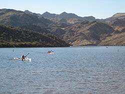 during the Desert Rage Adventure Race 2005 | |
| Location |
Maricopa County, Arizona, United States |
| Coordinates | 33°33′56″N 111°32′10″W / 33.5656°N 111.5361°WCoordinates: 33°33′56″N 111°32′10″W / 33.5656°N 111.5361°W |
| Lake type | reservoir |
| Primary inflows | Salt River |
| Primary outflows | Salt River |
| Basin countries | United States |
| Surface area | 1,264 acres (512 ha) |
| Average depth | 90 ft (27 m) |
| Surface elevation | 1,506 ft (459 m) |
Saguaro Lake is the fourth reservoir on the Salt River formed by the Stewart Mountain Dam in the U.S. state of Arizona. The lake is off State Route 87, about halfway between Phoenix and the ghost town of Sunflower. The dammed end of the lake is at 33°33′56″N 111°32′10″W / 33.5656°N 111.5361°W, at an elevation of 1,506 feet (459 m).
This lake is within the Tonto National Forest; the facilities are managed by that authority.
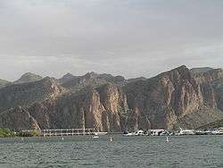
Saguaro Lake and marina. (2007)
Fish species
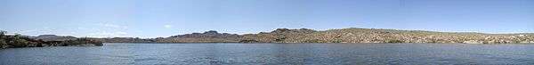
Panoramic photo of Saguaro Lake

Lake Saguaro Hiking Trail
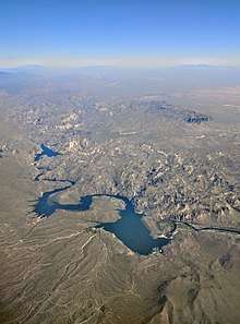
Aerial view of the lake and the Salt River
References
- Arizona Fishin' Holes, Phoenix, AZ: Arizona Game and Fish Department, Information and Education Division, 2007
External links
- Arizona Game and Fish Saguaro Lake Website
- Daily Water Level report from SRP
- Arizona Boating Locations Facilities Map
- Arizona Fishing Locations Map
- Video of Saguaro Lake
| Wikimedia Commons has media related to Lake Saguaro, Arizona. |
This article is issued from
Wikipedia.
The text is licensed under Creative Commons - Attribution - Sharealike.
Additional terms may apply for the media files.