Utah State Route 63
| ||||
|---|---|---|---|---|
.png) | ||||
| Route information | ||||
| Defined by Utah Code §72-4-112 | ||||
| Maintained by UDOT | ||||
| Length | 2.630 mi[1] (4.233 km) | |||
| Existed | 1975[2]–present | |||
| Major junctions | ||||
| South end | North boundary of Bryce Canyon National Park | |||
| North end |
| |||
| Highway system | ||||
| ||||

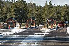
Utah State Route 63 (SR-63) is a state highway in the U.S. state of Utah. Just 2.63 miles (4.23 km) long, it serves as a connection between Utah State Route 12 (a scenic byway) and Bryce Canyon National Park.
Route description
Starting from the northern edge of Bryce Canyon National Park, the route runs northward, passing a view area, and exiting Dixie National Forest within the first mile. It continues north until its terminus at the intersection with SR-12 less than two miles later.
History
Previous designation
This route number was originally in use from 1931 – 1971 as a route from Salina to Scipio. The route number was withdrawn when this route was transferred to SR-26, and subsequently designated as part of US-50.
Current designation
Utah State Route 12 originally had a short spur serving Bryce Canyon. This spur was split off into a distinct highway, SR-63, in 1975.[2]
Major intersections
The entire route is in Garfield County.
| Location | mi[1] | km | Destinations | Notes | |
|---|---|---|---|---|---|
| | 0.000 | 0.000 | North boundary of Bryce Canyon National Park | Southern terminus | |
| 0.494 | 0.795 | View area | |||
| Tropic Junction | 2.630 | 4.233 | Northern terminus | ||
| 1.000 mi = 1.609 km; 1.000 km = 0.621 mi | |||||
| Wikimedia Commons has media related to Utah State Route 63. |
References
- 1 2 "State Route 63 Highway reference". Utah Department of Transportation. Retrieved 2009-07-08.
- 1 2 "State Route 63 Resolutions". Utah Department of Transportation. November 2008. Retrieved 2009-07-08.