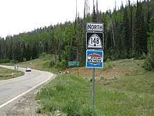
Utah State Route 148
| ||||
|---|---|---|---|---|
| Cedar Breaks Scenic Byway | ||||
| Route information | ||||
| Defined by Utah Code §72-4-120 | ||||
| Maintained by UDOT | ||||
| Length | 2.544 mi[1] (4.094 km) | |||
| Existed | 1985[2]–present | |||
| Major junctions | ||||
| South end |
| |||
| North end | Cedar Breaks National Monument boundary | |||
| Highway system | ||||
| ||||

State Route 148 (SR-148) is a state highway in the U.S. state of Utah. The entire highway has been designated the Cedar Breaks Scenic Byway as part of the Utah Scenic Byways and National Forest Scenic Byway programs.
Route description
The route starts at its intersection with State Route 14 in Cedar Canyon. From here it travels north approximately 2.5 miles (4.0 km) north to its terminus at the south boundary of Cedar Breaks National Monument.[1] While the route ends here, continuing north along the road into the park leads to Utah's Patchwork Parkway/Brian Head-Lake Panguitch Scenic Byway (SR-143).[2][3]
History
Prior to 1969, SR-55 connected SR-14 with the southern boundary of Cedar Breaks National Monument. That year, as part of a major realignment of state highways, SR-55 was deleted and its road was designated as part of SR-143. This left SR-143 as a non-contiguous highway, as the portion going through the national monument was not part of the highway designation.[4]
In 1985, the southern portion of SR-143 between SR-14 and the southern Cedar Breaks National Monument boundary was re-designated State Route 148, with no further changes to this highway. The route was designated as a Utah Scenic Byway as the Cedar Breaks Scenic Byway, with a National Forest Scenic Byway designation following on February 6, 1991.[5]
Major intersections
The entire route is in rural Iron County.
| mi[1] | km | Destinations | Notes | ||
|---|---|---|---|---|---|
| 0.000 | 0.000 | Southern terminus | |||
| 2.544 | 4.094 | South boundary of Cedar Breaks National Monument | Northern terminus | ||
| 1.000 mi = 1.609 km; 1.000 km = 0.621 mi | |||||
References
Route map:
- 1 2 3 "State Route 148 Highway reference" (PDF). Utah Department of Transportation. May 2008. Retrieved 2009-08-13.
- 1 2 "State Route 148 Resolutions" (PDF). Utah Department of Transportation. November 2008. Retrieved 2009-08-13.
- ↑ Bing Maps (Map). Microsoft Corporation. Retrieved 2009-09-01.
- ↑ "State Route 143 Resolutions" (PDF). Utah Department of Transportation. November 2008. Retrieved 2009-07-15.
- ↑ "Cedar Breaks Scenic Byway (U-148) - Official Designations". Federal Highway Administration. Retrieved 2009-08-13.