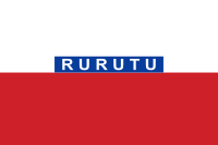
Rurutu
 NASA picture of Rurutu Island | |
 Rurutu Location in French Polynesia | |
| Geography | |
|---|---|
| Location | Pacific Ocean |
| Coordinates | 22°28′30″S 151°20′30″W / 22.47500°S 151.34167°W |
| Archipelago | Australes |
| Area | 33.32 km2 (12.86 sq mi) |
| Length | 10.8 km (6.71 mi) |
| Width | 5.3 km (3.29 mi) |
| Highest elevation | 385 m (1,263 ft) |
| Highest point | Manureva |
| Administration | |
|
France | |
| Overseas collectivity | French Polynesia |
| Administrative subdivision | Australes |
| Commune | Rurutu |
| Demographics | |
| Population | 2404[1] (2016) |
| Pop. density | 71 /km2 (184 /sq mi) |
| Rurutu | ||
|---|---|---|
| Commune | ||
| ||
 | ||
| Country | France | |
| Overseas collectivity | French Polynesia | |
| Government | ||
| • Mayor | Frédéric Riveta | |
| Area1 | 33.32 km2 (12.86 sq mi) | |
| Population (2016)2 | 2,404 | |
| • Density | 72/km2 (190/sq mi) | |
| INSEE/Postal code | 98744 /98753 | |
| Elevation | 0–385 m (0–1,263 ft) | |
|
1 French Land Register data, which excludes lakes, ponds, glaciers > 1 km2 (0.386 sq mi or 247 acres) and river estuaries. 2 Population without double counting: residents of multiple communes (e.g., students and military personnel) only counted once. | ||
Rurutu is the northernmost island in the Austral archipelago of French Polynesia, and the name of a commune consisting solely of that island. It is situated 572 km (355 mi) south of Tahiti.
Geologically, Rurutu was initially formed 12 million years ago by the Macdonald hotspot, a hotspot associated with the Macdonald seamount. Over the next 10 million years, erosion shrank the island until it was almost an atoll. Then, just over a million years ago, Rurutu passed over the Arago hotspot, which lifted it roughly 150 meters. Steep sea cliffs of ancient coral lifted by the event — called makatea — now largely encircle the island. These are riddled with caves filled with concretions — indeed, Rurutu is largely unique among islands in French Polynesia in that its historic inhabitants were cave-dwelling.

Because it is endowed with a fringing reef, Rurutu has in recent years become known for whale watching: Humpback whales come and reproduce here between July and October within easy sighting distance from the beach.
Although its tiny community still subsists primarily on fishing and basic agriculture, tourism has been a growing industry, especially since François Mitterrand's visit in 1990. Whale watching season sees the bulk of tourists, but the largely untouched native culture, the white sand beaches, and the lush tropical flora draw small numbers of tourists year-round.
Administration
Rurutu Island is part of the commune of Rurutu, which itself consists of the following associated communes:
- Avera (Rurutu)
- Hauti
- Moerai
See also
References
- ↑ "Population". Institut de la statistique de la Polynésie française. Retrieved 7 January 2015.
External links
| Wikimedia Commons has media related to Rurutu. |
