Runyon Watershed
| Runyon Watershed | |
|---|---|
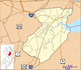 Runyon Watershed Runyon in Middlesex County, New Jersey | |
| Coordinates: 40°26′03″N 74°19′56″W / 40.43417°N 74.33222°WCoordinates: 40°26′03″N 74°19′56″W / 40.43417°N 74.33222°W | |
| Country | United States |
| State | New Jersey |
| County | Middlesex |
| Township and Borough | Old Bridge and Sayreville |
| Elevation[1] | 30 ft (9 m) |
| GNIS feature ID | 879863[1] |
The Runyon Watershed is a reservoir system located in Old Bridge Township, New Jersey just south of Sayreville. It is operated by the Middlesex Water Company. The 1,100 acres (450 ha) watershed area was first established in the late 1800 when it was purchased by the city of Perth Amboy, which developed a reservoir and waterworks in the 1920s, and turned over management to the company in 2003.[2] The area is protected, with more than 500 acres of the tract are wetlands that are from development by the state’s 1990 Watershed Moratorium Act [3][3] [4][5] [6][7][8][9] A weather station in Runyon recorded a high temperature of 110 °F (43 °C) on July 10, 1936, setting the record for the hottest temperature ever recorded in New Jersey.[10]
References
- 1 2 "Runyon". Geographic Names Information System. United States Geological Survey.
- ↑ http://www.middlesexwater.com/upload/family/utility-service-affiliates-perth-amboy-inc/water-quality-report/USAPA_CCR_2014_Web.pdf
- 1 2 Launay, Michael J. (2002), Old Bridge, Arcadia Publishing, ISBN 9780738509921
- ↑ "Sale of Runyon property to county still pending - sub.gmnews.com - Suburban". gmnews.com. Archived from the original on 20 September 2015. Retrieved 13 June 2015.
- ↑ "Old Bridge seeks to pump own water from reservoir in effort to reduce costs". NJ.com. Retrieved 13 June 2015.
- ↑ "Runyon Water Shed Trestle". raritanriver-rr.com. Retrieved 13 June 2015.
- ↑ "Planning for Groundwater Protection". google.nl. Retrieved 13 June 2015.
- ↑ Locality Search, State of New Jersey. Accessed February 14, 2015.
- ↑ Google (February 14, 2015). "Runyon, New Jersey" (Map). Google Maps. Google. Retrieved February 14, 2015.
- ↑ National Climatic Data Center. "State Climate Extremes Committee (SCEC)". Retrieved February 14, 2015.
This article is issued from
Wikipedia.
The text is licensed under Creative Commons - Attribution - Sharealike.
Additional terms may apply for the media files.