Ruins of Loropéni
| UNESCO World Heritage site | |
|---|---|
%2CBF_sun15may2016-1106h.jpg) Remains of defensive walls, May 2016 | |
| Location | Loropéni, Loropéni Department, Poni Province, Sud-Ouest Region, Burkina Faso |
| Criteria | Cultural: (iii) |
| Reference | 1225rev |
| Inscription | 2009 (33rd Session) |
| Area | 1.113 ha (0.00430 sq mi) |
| Buffer zone | 278.4 ha (1.075 sq mi) |
| Coordinates | 10°18′37″N 3°33′46″W / 10.31028°N 3.56278°WCoordinates: 10°18′37″N 3°33′46″W / 10.31028°N 3.56278°W |
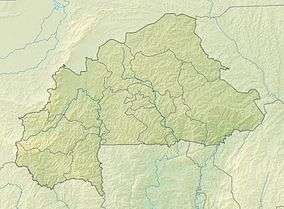 Location of Ruins of Loropéni in Burkina Faso | |
The ruins of Loropéni are an ancient heritage site near the town of Loropéni in southern Burkina Faso. They were added to the UNESCO World Heritage List in 2009. These ruins are the country's first World Heritage site. The site, which spans 11,130 square metres (119,800 sq ft), includes an array of stone walls that comprised an ancient fortress, the best preserved of ten in the area. They date back at least a thousand years. The settlement was occupied by the Lohron or Kulango people and prospered from the trans-Saharan gold trade, reaching its height between the 14th and 17th centuries AD. It was abandoned in the early 19th century.[1]
%2CBF_sun15may2016-1119h.jpg)
Archeological excavations at the ruins, May 2016
References
- ↑ "Ruins of Loropéni". UNESCO World Heritage List. Retrieved 12 June 2015.
Further reading
- Somé, Magloire, and Lassina Simporé. Lieux de mémoire, patrimoine et histoire en Afrique de l’Ouest: Aux origines des Ruines de Loropéni, Burkina Faso. Archives contemporaines, 2014.
- Royer, Bertrand. Le fil d’Ariane du patrimoine. Du musée ethnographique de Gaoua au site UNESCO de Loropéni (Burkina Faso). Géographie et cultures 79 (2011): 109-125.
- Royer, Bertrand. "Patrimoine Mondial de l'Unesco et mise en valeur des ruines de Loropéni." Net et terrain: ethnographie de la n@ture en Afrique (2011): 94-122.
External links
This article is issued from
Wikipedia.
The text is licensed under Creative Commons - Attribution - Sharealike.
Additional terms may apply for the media files.