Ruben Berta International Airport
| Rubem Berta International Airport Aeroporto Internacional de Uruguaiana - Rubem Berta | |||||||||||||||
|---|---|---|---|---|---|---|---|---|---|---|---|---|---|---|---|
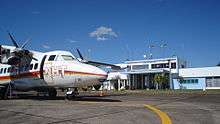 A NHT Linhas Aéreas aircraft at Uruguaiana | |||||||||||||||
| Summary | |||||||||||||||
| Airport type | Public | ||||||||||||||
| Operator | Infraero | ||||||||||||||
| Serves | Uruguaiana | ||||||||||||||
| Elevation AMSL | 78 m / 256 ft | ||||||||||||||
| Coordinates | 29°46′55″S 057°02′18″W / 29.78194°S 57.03833°WCoordinates: 29°46′55″S 057°02′18″W / 29.78194°S 57.03833°W | ||||||||||||||
| Website | Infraero URG | ||||||||||||||
| Map | |||||||||||||||
 URG Location in Brazil | |||||||||||||||
| Runways | |||||||||||||||
| |||||||||||||||
| Statistics (2015) | |||||||||||||||
| |||||||||||||||
Rubem Berta International Airport (IATA: URG, ICAO: SBUG) is the airport serving Uruguaiana, Brazil. It is named after Ruben Berta (1907–1966), third Manager-Director of Varig.[4] Even though Ruben Berta was spelled as Ruben the airport's official name is spelled Rubem.
It is operated by Infraero.
History
The airport was inaugurated in 1945 and the terminal building in 1968. On September 29, 1967, the airport was renamed after Ruben Berta.
Airlines and destinations
| Airlines | Destinations |
|---|---|
| Azul Brazilian Airlines | Porto Alegre |
Access
The airport is located 9 km (6 mi) from downtown Uruguaiana.
See also
References
- ↑ "Estatísticas" (in Portuguese). Infraero. 2 February 2016. Retrieved 6 July 2016.
- ↑ "Aeroporto Internacional de Uruguaiana - Rubem Berta" (in Portuguese). Infraero.
- ↑ "Lista de aeródromos públicos" (in Portuguese). ANAC.
- ↑ Beting, Gianfranco; Beting, Joelmir (2009). Varig: Eterna Pioneira (in Portuguese). Porto Alegre and São Paulo: EDIPUCRS and Beting Books. pp. 44–50. ISBN 978-85-7430-901-9.
External links
- Airport information for SBUG at World Aero Data. Data current as of October 2006.Source: DAFIF.
- Airport information for SBUG at Great Circle Mapper. Source: DAFIF (effective October 2006).
- Current weather for SBUG at NOAA/NWS
- Accident history for URG at Aviation Safety Network
%
Airports in Rio Grande do Sul | |
|---|---|
|
This article is issued from
Wikipedia.
The text is licensed under Creative Commons - Attribution - Sharealike.
Additional terms may apply for the media files.