Royal George, Tasmania
| Royal George Tasmania | |
|---|---|
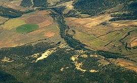 Aerial photo from the east | |
 Royal George | |
| Coordinates | 41°49′20″S 147°53′28″E / 41.82222°S 147.89111°ECoordinates: 41°49′20″S 147°53′28″E / 41.82222°S 147.89111°E |
| Population | 127 (2006 census)[1] |
| Postcode(s) | 7213[2] |
| LGA(s) | North Midlands Council |
| State electorate(s) | Lyons |
| Federal Division(s) | Lyons |
Royal George is a village in north east Tasmania on the St. Pauls River. At the 2006 census, Royal George had a population of 127.[1]
It was a mining village, with the mine and locality named after one of the British Royal Navy vessels named HMS Royal George from the 19th century. HMS Royal George was under the command of Captain Robert Hepburn during the Napoleonic Wars Captain Hepburn settled nearby at Roy's Hill in 1828.[3]
History
The first Royal George Post Office opened on 5 May 1914 and closed in 1920. The second office opened in 1955 and closed in 1971. [4] Royal George is served by a school bus which takes students to Avoca Primary School and Campbell Town District High School. As of 2018, there is a population of around 28 people living in Royal George [5]
References
- 1 2 Australian Bureau of Statistics (25 October 2007). "Royal George (State Suburb)". 2006 Census QuickStats. Retrieved 22 November 2011.
- ↑ White Pages Canberra 2008
- ↑ Tasmania Central Portal
- ↑ Premier Postal History. "Post Office List". Premier Postal Auctions. Retrieved 16 June 2012.
- ↑ Arndt, Dinah (23 June 2011). "Concern for children who will spend hours on buses". The Examiner. Retrieved 18 April 2017.