Rowes Bay, Queensland
| Rowes Bay Townsville, Queensland | |||||||||||||||
|---|---|---|---|---|---|---|---|---|---|---|---|---|---|---|---|
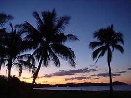 Dusk at Soroptimist Park, Rowes Bay; looking northwards to Cape Pallarenda Conservation Park | |||||||||||||||
| Population | 539 (2011 census)[1] | ||||||||||||||
| Postcode(s) | 4810 | ||||||||||||||
| LGA(s) | City of Townsville | ||||||||||||||
| State electorate(s) | Townsville | ||||||||||||||
| Federal Division(s) | Herbert | ||||||||||||||
| |||||||||||||||
Rowes Bay is a suburb of the City of Townsville, Queensland, Australia.[2] In the 2011 census, Rowes Bay had a population of 539 people.[1]
Description
Rowes Bay is located in a low-lying area adjacent to the Cleveland Bay beach. Its borders are determined by the coast, Townsville Airport and Mundy Creek, and only a small portion of the suburb's area is taken up by housing. Neighbouring suburbs include Garbutt, West End and Belgian Gardens; however, Rowes Bay is relatively isolated from other suburbs due to its location surrounded by the Town Common. The Townsville Cemetery (also known as Belgian Gardens Cemetery) and a retirement village are also located within the suburb.
Attractions
Rowes Bay is dominated by a scenic 10 kilometres (6.2 mi) Cleveland Bay beach, which has sweeping views of Magnetic Island. The beach is punctuated at intervals by tidal creeks. A short drive up Cape Pallarenda Rd. is located the suburb of Pallarenda which is equipped with a beachfront park and boat ramp. Cycling or jogging alone the sealed foreshore pathway is a popular pastime but swimming is not encouraged due to a risk of crocodile or jellyfish attack.
At the southern end of the beach area is Soroptimist Park, which has lawns, barbecue facilities and an adventure playground designed specifically to be suitable for all children including those with disabilities. The park includes several attractive pieces of public art, contributed in 1988 and 1994. The northern end of the beach is a popular site for Kitesurfing.
History
Rowes Bay was named after Charles Seville Rowe, one of the first settlers at Cleveland Bay. Only after the Second World War did the name Rowes come into general use - prior to this the area was recorded as Rose Bay and Ross Bay.[3]
Gallery
 Detail of public art sculpture, Soroptimist Park, Townsville.
| Urban |
|
|---|---|
| Rural |
|
| Northern Beaches | |
| Magnetic Island | |
References
- 1 2 Australian Bureau of Statistics (31 October 2012). "Rowes Bay". 2011 Census QuickStats. Retrieved 16 January 2016.

- ↑ "Rowes Bay (entry 46542)". Queensland Place Names. Queensland Government. Retrieved 15 April 2014.
- ↑ Parks Services - Townsville City Council