Round O, South Carolina

Round O (formerly also called Round) is an unincorporated community in Colleton County, South Carolina, United States. Its elevation is 36 feet (11 m), its ZIP code is 29474, and it is located near the intersection of Cottageville Highway (US 17) and Round O Road (S-15-45). Its geographic coordinates are [32°56.2′N 80°32.5′W / 32.9367°N 80.5417°W (32.9371, −80.5409).[1]]. There are numerous churches within the community, including Canaan Baptist Church and Mount Sinai Baptist. It also has a small US Post Office.
According to tradition, the community received its name from a local Native American whose name was too long to pronounce, hence the name Round O, and painted his torso with a circular design.[2]
On J. G. W. De Brahm's 1757 "Map of South Carolina and a Part of Georgia," a round geographical feature labeled "Round O Savannah" is clearly visible west of the Edisto River in St. Bartholomew's Parish. [3]
References
- ↑ U.S. Geological Survey Geographic Names Information System: Round O, South Carolina
- ↑ Jun 9, 1971. "Some towns sure have funny names". The Miami News. pp. 4A. Retrieved 19 May 2015.
- ↑ De Brahm, John Gerar William. "A map of South Carolina and a Part of Georgia" (Map). "A Map of South Carolina and a Part of Georgia" (London : Thomas Jefferys, 1757). Retrieved 15 June 2018.
Municipalities and communities of Colleton County, South Carolina, United States | ||
|---|---|---|
| City | 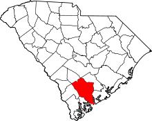 | |
| Towns | ||
| CDPs | ||
| Unincorporated communities | ||