Rotbüelspitz
| Rotbüelspitz | |
|---|---|
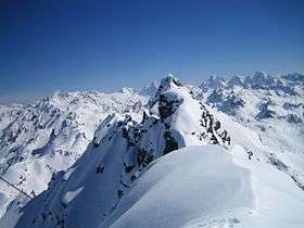 View from Rotbühelspitze in winter towards Silvretta | |
| Highest point | |
| Elevation | 2,852 m (9,357 ft) |
| Prominence | 42 m (138 ft) [1] |
| Isolation | 0.35 kilometres (0.22 mi) |
| Parent peak | Isentällispitz |
| Coordinates | 46°54′57.4″N 9°57′32.1″E / 46.915944°N 9.958917°ECoordinates: 46°54′57.4″N 9°57′32.1″E / 46.915944°N 9.958917°E |
| Geography | |
 Rotbüelspitz Location in the Alps | |
| Location |
Graubünden, Switzerland Vorarlberg, Austria |
| Parent range | Silvretta Alps |
| Climbing | |
| Easiest route | Gargellen (Austria) - Wintertal - Summit |
The Rotbüelspitz (also spelled Rotbühelspitze) is a mountain of the Silvretta Alps, located on the border between Austria and Switzerland. It is located north of the slightly higher Isentällispitz.
References
- ↑ Retrieved from the Swisstopo topographic maps and Google Earth. The key col is located south of the summit at 2,810 metres.
External links
| Wikimedia Commons has media related to Rotbühelspitze. |
This article is issued from
Wikipedia.
The text is licensed under Creative Commons - Attribution - Sharealike.
Additional terms may apply for the media files.