Rossa Point
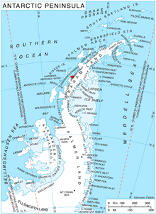
Location of Velingrad Peninsula on Graham Coast, Antarctic Peninsula.
Rossa Point (65°57′S 65°14′W / 65.950°S 65.233°WCoordinates: 65°57′S 65°14′W / 65.950°S 65.233°W) is a point 2 nautical miles (3.7 km) northeast of Ferin Head on Velingrad Peninsula, the west coast of Graham Land, Antarctica. Charted by the British Graham Land Expedition (BGLE) under Rymill, 1934-37. Named by the United Kingdom Antarctic Place-Names Committee (UK-APC) in 1959 for Anders Rossa, a Jokkmokk Sami who, with Pava Tuorda, accompanied A.E. Nordenskjold to Greenland in 1883 and first demonstrated the possibilities of skis for polar travel.
Maps
- British Antarctic Territory. Scale 1:200000 topographic map. DOS 610 Series, Sheet W 65 64. Directorate of Overseas Surveys, Tolworth, UK, 1971.
References
![]()
This article is issued from
Wikipedia.
The text is licensed under Creative Commons - Attribution - Sharealike.
Additional terms may apply for the media files.