Rosenfeld, Texas
| Rosenfeld, Texas | |
|---|---|
| Unincorporated community | |
 Rosenfeld, Texas  Rosenfeld, Texas | |
| Coordinates: Coordinates: 30°06′13″N 102°45′08″W / 30.10361°N 102.75222°W | |
| Country | United States |
| State | Texas |
| County | Brewster |
| Elevation | 3,671 ft (1,119 m) |
| Time zone | UTC-6 (Central (CST)) |
| • Summer (DST) | UTC-5 (CDT) |
| Area code(s) | 432 |
| GNIS feature ID | 1380908[1] |
Rosenfeld is an unincorporated community in west central Brewster County, Texas, United States.[1] It is 73 miles east of Alpine, Texas and 25 miles west of Sanderson, Texas. Not much is known about Rosenfeld except that it is on a connecting road to U.S. Highway 90 and is on the Pacific Railroad which could mean that it used to be a railway stop.
References
Municipalities and communities of Brewster County, Texas, United States | ||
|---|---|---|
| City | 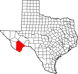 | |
| CDPs | ||
| Other unincorporated communities | ||
| Ghost Towns | ||
| Annexed former counties | ||
This article is issued from
Wikipedia.
The text is licensed under Creative Commons - Attribution - Sharealike.
Additional terms may apply for the media files.