Rose Harbour, British Columbia
| Rose Harbour | |
|---|---|
| Rose Harbour | |
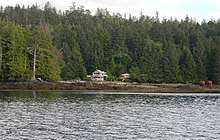 Rose Harbour from the Houston Stewart Channel | |
 Rose Harbour Location of Rose Harbour in British Columbia | |
| Coordinates: 52°09′00″N 131°04′30″W / 52.15000°N 131.07500°WCoordinates: 52°09′00″N 131°04′30″W / 52.15000°N 131.07500°W | |
| Country |
|
| Province |
|
| Region | North Coast |
| Regional district | Skeena-Queen Charlotte |
| Elevation | 0 m (0 ft) |
| Population (2011) | |
| • Total | 6 |
| Time zone | UTC−8 (PST) |
| • Summer (DST) | UTC−7 (PDT) |
| Forward sortation area | V0T |
| Area code(s) | 250 / 778 / 236 |
Rose Harbour is an unincorporated settlement on the north coast of Kunghit Island, on the south shore of the Houston Stewart Channel, in Haida Gwaii. It is within the bounds of Gwaii Haanas National Park Reserve and Haida Heritage Site. It is the only privately-owned property within Gwaii Haanas.[1]
Rose Harbour was established as a whaling station in 1910 by the Queen Charlotte Whaling Company and operated until 1943.[2] A monument survives to Chinese and Japanese people who died in the whaling trade.
Currently, there is a small group of houses at Rose Harbour, which offer lodging and dining services to kayakers and other tourists.[3] There has been significant legal friction between Rose Harbour residents on one side and the Park administration and Canadian government on the other.[4]
Images
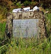 Memorial for whaling fatalities
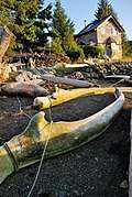 Whale bones on the beach
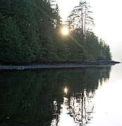 Sunset at Rose Harbour
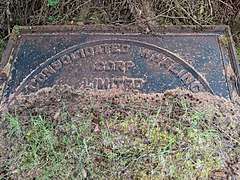 Consolidated Whaling Corporation plaque
References
- ↑ "Gwaii Haanas: National Park Reserve and Haida Heritage Site: Management Plan for the Terrestrial Area". Archipelago Management Board. 2010. p. 10. Retrieved 2018-07-18.
- ↑ "Rose Harbour". 2010-12-06. Retrieved 2018-07-18.
- ↑ "Civilization's edge: Haida Gwaii teeters on B.C. Pacific coast". 2011-02-07. Retrieved 2018-07-18.
- ↑ "Hanisch v. Canada, 2004 BCCA 539" (PDF). 2004-10-21. Retrieved 2018-07-18.