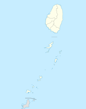
Rose Hall, Saint Vincent and the Grenadines
| Rose Hall | |
|---|---|
 Rose Hall Location in Saint Vincent and the Grenadines | |
| Coordinates: 13°16′13″N 061°14′25″W / 13.27028°N 61.24028°WCoordinates: 13°16′13″N 061°14′25″W / 13.27028°N 61.24028°W[1] | |
| Country | Saint Vincent and the Grenadines |
| Island | Saint Vincent |
| Parish | Saint David |
Rose Hall at 1142 feet is the highest settlement in St. Vincent and the Grenadines. It is located in Saint David Parish on the island of Saint Vincent in Saint Vincent and the Grenadines.[2] It is located to the east of Westwood, south of Rose Bank, just to the north of Spring Village and far west of Byera on the windward coast. It is uniquely positioned for pictures of La Soufriere volcano. St Lucia across the ocean. The mountain range and ships in the Caribbean Sea. It has a rich cultural heritage,organic farms with and it is one area that any plant in the hemisphere grows. It has a strong communal spirit and it hospitality knows no boundaries. It is one,if not the most safest stop to visit on the island
References
- ↑ "Rose Hall". Wikimapia. Retrieved 3 March 2013.
- ↑ "Rosehall". GEOnet Names Server. Retrieved 3 March 2012.
- Scott, C. R. (ed.) (2005) Insight guide: Caribbean (5th edition). London: Apa Publications.
This article is issued from
Wikipedia.
The text is licensed under Creative Commons - Attribution - Sharealike.
Additional terms may apply for the media files.