Rongbuk Glacier
The Rongbuk Glacier (simplified Chinese: 绒布冰川; traditional Chinese: 絨布冰川; pinyin: Róngbù Bīngchuān) is located in the Himalaya of southern Tibet. Two large tributary glaciers, the East Rongbuk Glacier and the West Rongbuk Glacier, flow into the main Rongbuk Glacier. It flows north and forms the Rongbuk Valley north of Mount Everest. The famous Rongbuk Monastery is located at the northern end of the Rongbuk valley. Mount Everest is the source of the Rongbuk Glacier and East Rongbuk Glacier.
Discovery
The English climber George Mallory first explored the main Rongbuk Valley and its glacier while searching for possible routes to the summit of Mount Everest during the first British Everest reconnaissance expedition of 1921.
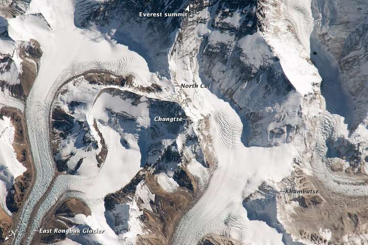
The East Rongbuk glacier was first explored by Edward Oliver Wheeler in August 1921 on the same expedition. Wheeler's exploration below the Lhakpa La pass led him on 3 August 1921 to realise that the East Rongbuk valley provided the key to a viable route to the summit of Everest.[1] A few weeks later a party consisting of George Mallory, Guy Bullock and Oliver Wheeler explored the head of the valley via the Lhakpa La pass to become the first people to reach the North Col of Everest and set foot on the slopes of that mountain. See 1921 British Reconnaissance Expedition.[2][3]
Location(s)
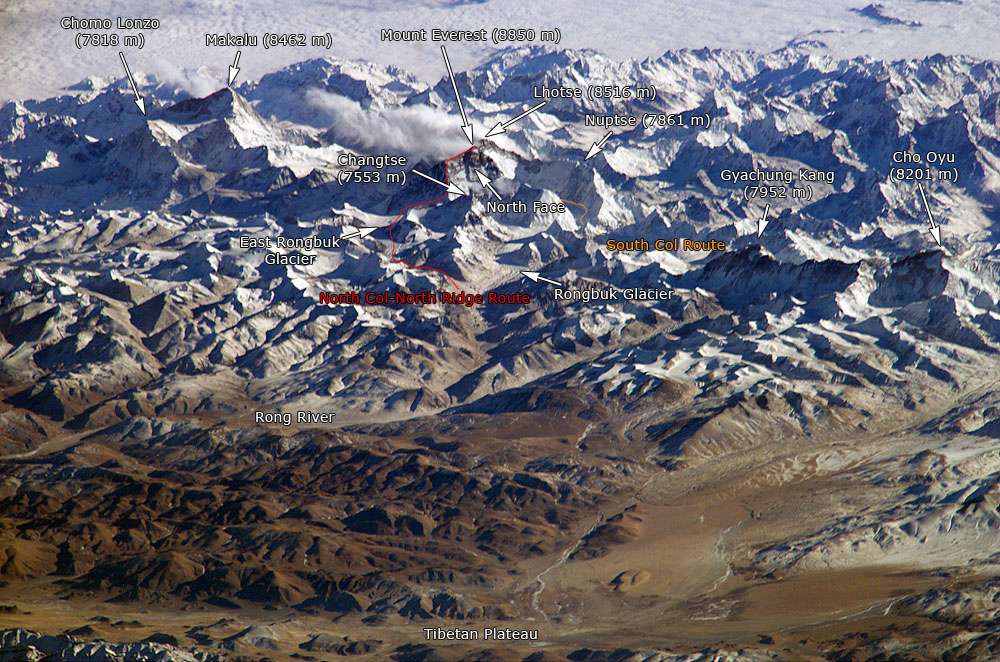

Route to Everest
Climbing expeditions attempting the normal route from Tibet use this glacier to reach the Advanced Base Camp of Mount Everest at the upper end of the East Rongbuk Glacier. From there, climbing expeditions try to summit Everest by the North Col and the northeast ridge.[4]
Environmental
Since 2007, American mountaineer and film-maker David Breashears has been chronicling the rapid disappearance of the Rongbuk glacier due to global climate change. Breashears has retraced the steps of Mallory's 1921 expedition, revealing a significant loss of ice mass across the West, Main and East Rongbuk Glaciers. In partnership with Asia Society and MediaStorm, Breashears' GlacierWorks[5] has made the photos available online. In 80 years, the Rongbuk has shrunk by more than 300 vertical feet across the entire glacier, approximately the height of the Statue of Liberty.
Image gallery
 Recent glacial animation, Mount Everest at the top right.
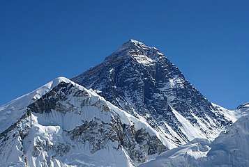
 View of Mount Everest from Rongbuk Valley, near foot/terminus of Rongbuk Glacier.
 View of Mount Everest and Rongbuk Monastery.
Overview
See also
References
- ↑ Wade Davis - Into the silence, Vintage Books, London, 2012.
- ↑ Eric Simonson, Jochen Hemmleb, and Larry Johnson. "Outside Online Archives". OutsideOnline.com. Archived from the original on 8 January 2009. Retrieved 2009-04-30.
- ↑ "Expedition to rewrite Everest history". BBC News. 1999-03-24. Retrieved 2009-04-30.
- ↑ "NOVA Online – Everest – Climb North – East Rongbuk Glacier". www.pbs.org. Retrieved 2009-04-30.
- ↑ "GlacierWorks". www.glacierworks.org. Retrieved 19 April 2018.
External links
| Wikimedia Commons has media related to Rongbuk Glacier. |
- Charles Howard-Bury, George Herbert Leigh-Mallory. Mount Everest: The Reconnaissance, 1921. Retrieved 2009-04-30.
- NOAA.gov: East Rongbuk Glacier, Mount Qomolangma
- Greenpeace.org: "Expedition documents melting Himalayan glaciers"
- Asia Society.org: "On Thinner Ice" Project" — with photos of the Rongbuk Glacier.

Coordinates: 28°6′7.2″N 86°51′54.87″E / 28.102000°N 86.8652417°E