Rolava
| Rolava | |
|---|---|
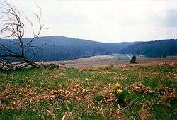 View of the Upper Rolava valley near Chaloupky | |
| Location |
|
| Physical characteristics | |
| Main source | north of Rolava (Přebuz), south of the Großer Kranichsee raised bog |
| River mouth |
In the Karlovy Vary quarter of Rybáře (Fischern) into the Ohře 50°13′56″N 12°50′45″E / 50.23233°N 12.84574°ECoordinates: 50°13′56″N 12°50′45″E / 50.23233°N 12.84574°E |
| Length | 36.7 km (22.8 mi) |
| Basin features | |
| Progression | Ohře→ Elbe→ North Sea |
| Basin size | 138.0 km (85.7 mi) |
The Rolava (German: Rohlau) is a left tributary of the Eger river (Czech: Ohře) in the northwest of the Czech Republic. It is 36.7 kilometres (22.8 mi) long, and its basin area is 138 square kilometres (53 sq mi).[1]
It rises in the Bohemian part of the Ore Mountains about 2 km north of the village of Rolava near the border with Saxony. North of its source is the raised bog of Großer Kranichsee, whose waters the Rolava partly collects. During its course in a mainly southeasterly direction the river flows through the abandoned village of Chaloupky and is joined by the Schwarzwasser stream coming from Hirschenstand (Jelení). It then flows through Neuhammer (Nové Hamry), the former district capital of Neudek (Nejdek) and the villages of Nová Role and Stará Role, known for their porcelain factories. In Karlovy Vary its discharges into the Eger west of the town centre.
References
- ↑ "Charakteristiky toků a povodí ČR - Rolava" (PDF) (in Czech). VÚV TGM. Retrieved 2018-05-08.