Rohožník, Malacky District
| Rohožník | |
| Town | |
 | |
| Official name: Rohožník | |
| Nickname: Ralboch | |
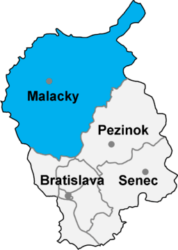
| Country | Slovakia |
|---|---|
| Region | Bratislava |
| District | Malacky |
| River | Rudava |
| Elevation | 201 m (659 ft) |
| Coordinates | 48°27′19″N 17°10′3″E / 48.45528°N 17.16750°ECoordinates: 48°27′19″N 17°10′3″E / 48.45528°N 17.16750°E |
| Highest point | Vysoká (Carpathian mountain) |
| Area | 27.44 km2 (11 sq mi) |
| Population | 3,456 (31.12.2013) |
| Density | 126/km2 (326/sq mi) |
| First mentioned | 1397 |
| Mayor | [Peter Švaral]] |
| Timezone | CET (UTC+1) |
| - summer (DST) | CEST (UTC+2) |
| Postal code | 906 38 |
| Phone prefix | 421-2 |
| Wikimedia Commons: Rohožník (Malacky District) | |
| Statistics: | |
| Website: | |
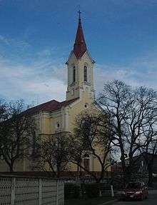
Church
Rohožník (German: Rohrbach) is a village in Malacky District in the Bratislava Region of western Slovakia close to the town of Malacky, northwest of Slovakia's capital Bratislava.
History
First historical record about the village is from book of Hungarian historian Carolus Péterffy "Sacra concilia ecclesiae Romano-catholicae in regno Hungariae celebrata" from year 1397.
Geography
The village lies at an altitude of 201 metres and covers an area of 27.44 km2.
External links
- http://www.statistics.sk/mosmis/eng/run.html
- "..::Obec Rohožník::." rohoznik.sk. Retrieved 2015-11-09.
- Peterffy, C. (1742). Sacra concilia ecclesiae romano-catholicae in regno Hungariae celebrata. Typis Haeredum Royerianrum. Retrieved 2015-11-09.
| Authority control |
|---|
This article is issued from
Wikipedia.
The text is licensed under Creative Commons - Attribution - Sharealike.
Additional terms may apply for the media files.