Robbins, Tennessee
| Robbins, Tennessee | |
|---|---|
| Census-designated place | |
 | |
 Robbins, Tennessee | |
| Coordinates: 36°21′12″N 84°35′22″W / 36.35333°N 84.58944°W | |
| Country | United States |
| State | Tennessee |
| County | Scott |
| Area[1] | |
| • Total | 1.747 sq mi (4.52 km2) |
| • Land | 1.747 sq mi (4.52 km2) |
| • Water | 0 sq mi (0 km2) |
| Elevation | 1,378 ft (420 m) |
| Population (2010)[2] | |
| • Total | 287 |
| • Density | 160/sq mi (63/km2) |
| Time zone | UTC-6 (Central (CST)) |
| • Summer (DST) | UTC-5 (CDT) |
| Area code(s) | 423 |
| GNIS feature ID | 1299586[3] |
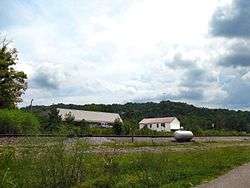
Robbins is an unincorporated community and census-designated place (CDP) in Scott County, Tennessee.[3] As of the 2010 census, its population is 287.[2] It is concentrated along U.S. Route 27 between Huntsville and Elgin, in Tennessee's Cumberland Plateau region. The community is served by Robbins Elementary School. It is also home to Barton Chapel, a 1920s-era Gothic Revival church designed by noted architectural firm, Barber and McMurry.
The community is probably named for a family that lived in the vicinity when a post office was established in 1880.[4]
Notable people
- Bruce Fairchild Barton, advertising executive who represented New York in the United States House of Representatives from 1937 to 1940
- Harry C. Stonecipher, former president and CEO of McDonnell Douglas and Boeing
References
- ↑ "US Gazetteer files: 2010, 2000, and 1990". United States Census Bureau. 2011-02-12. Retrieved 2011-04-23.
- 1 2 "American FactFinder". United States Census Bureau. Retrieved 2011-05-14.
- 1 2 "Robbins, Tennessee". Geographic Names Information System. United States Geological Survey.
- ↑ Larry Miller, Tennessee Place Names (Indiana University Press, 2001), p. 178.
External links
| Wikimedia Commons has media related to Robbins, Tennessee. |
- Robbins, Tennessee at Curlie (based on DMOZ)
Municipalities and communities of Scott County, Tennessee, United States | ||
|---|---|---|
| Towns | ||
| CDPs | ||
| Unincorporated communities | ||
| Footnotes | ‡This populated place also has portions in an adjacent county or counties | |
This article is issued from
Wikipedia.
The text is licensed under Creative Commons - Attribution - Sharealike.
Additional terms may apply for the media files.