Rivière-Mistassini, Quebec
| Rivière-Mistassini | |
|---|---|
| Unorganized territory | |
 | |
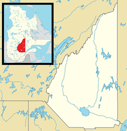 Rivière-Mistassini Location in Saguenay–Lac-Saint-Jean Quebec. | |
| Coordinates: 49°55′N 72°50′W / 49.917°N 72.833°WCoordinates: 49°55′N 72°50′W / 49.917°N 72.833°W[1] | |
| Country |
|
| Province |
|
| Region | Saguenay–Lac-Saint-Jean |
| RCM | Maria-Chapdelaine |
| Constituted | unspecified |
| Government[2] | |
| • Federal riding | Roberval—Lac-Saint-Jean |
| • Prov. riding | Roberval |
| Area[2][3] | |
| • Total | 18,753.80 km2 (7,240.88 sq mi) |
| • Land | 18,460.51 km2 (7,127.64 sq mi) |
| Population (2011)[3] | |
| • Total | 31 |
| • Density | 0.0/km2 (0/sq mi) |
| • Pop (2006–11) |
|
| • Dwellings | 16 |
| Time zone | UTC-5 (EST) |
| • Summer (DST) | UTC-4 (EDT) |
| Area code(s) | 418 and 581 |
Rivière-Mistassini is an unorganized territory in the Canadian province of Quebec, located in the regional county municipality of Maria-Chapdelaine. The territory had a population of 31 as of the Canada 2011 Census, and covered a land area of 18,460.51 km2.
The eponymous Mistassini River has its source in the far northern part of the territory and entirely bisects it from north to south.
Demographics
Population trend:[4]
- Population in 2011: 31 (2006 to 2011 population change: 210.0%)
- Population in 2006: 10
- Population in 2001: 0
- Population in 1996: 0
- Population in 1991: 0
Private dwellings occupied by usual residents: 14 (total dwellings: 16)
References
- ↑ Reference number 149743 of the Commission de toponymie du Québec (in French)
- 1 2 Ministère des Affaires municipales, des Régions et de l'Occupation du territoire - Répertoire des municipalités: Rivière-Mistassini
- 1 2 "Rivière-Mistassini census profile". 2011 Census data. Statistics Canada. Retrieved 2010-11-24.
- ↑ Statistics Canada: 1996, 2001, 2006, 2011 census
Adjacent Municipal Subdivisions | |
|---|---|
| Cities & Towns | |
|---|---|
| Municipalities | |
| Parishes | |
| Villages | |
| Unorganized territories | |
| |
This article is issued from
Wikipedia.
The text is licensed under Creative Commons - Attribution - Sharealike.
Additional terms may apply for the media files.