River Tud
| Tud | |
| River | |
 | |
| Country | England |
|---|---|
| Region | Norfolk |
| Part of | River Wensum |
| Source | |
| - location | north of Shipdham |
| - elevation | 76 m (249 ft) |
| - coordinates | 52°38′35″N 0°54′35″E / 52.6430°N 0.9097°E |
| Mouth | River Wensum |
| - location | Hellesdon |
| - elevation | 4 m (13 ft) |
| - coordinates | 52°38′47″N 1°14′55″E / 52.6464°N 1.2486°ECoordinates: 52°38′47″N 1°14′55″E / 52.6464°N 1.2486°E |
| Length | 27.0 km (17 mi) |
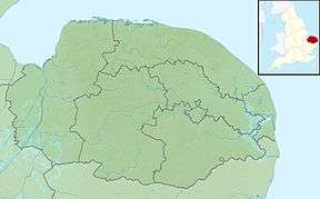 Location of the river mouth within Norfolk | |
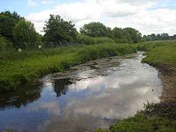
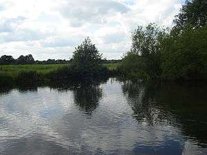
River Tud is a tributary of the River Wensum, Norfolk in the East of England. The Tud's source is just south of East Dereham and it flows in an easterly direction for 27 kilometres (17 mi) to its confluence with the Wensum below Hellesdon mill.
Course
The Tud passes through the villages of North Tuddenham, Hockering, East Tuddenham, Honingham, Easton, Costessey and finally flows under the Marriott's Way before joining the Wensum at Hellesdon Mill.
Ecology
The Tud's water is crystal clear, shallow, fast-flowing and has lush weed beds full of aquatic life including crayfish, lampreys, bullheads, freshwater shrimps and stone loach.
Angling
The river is well known for the quality dace fishing. Trout can also be caught particularly in the upper reaches. Angling is mostly private. Unfortunately the river has suffered from the odd case of pollution.
Further reading
- Where to Fish in Norfolk and Suffolk by John Wilson ISBN 0-7117-0183-0
| Wikimedia Commons has media related to River Tud. |