Esla (river)
| Esla | |
|---|---|
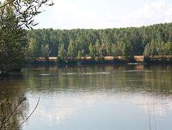 View of the Esla River | |
| Country | Spain |
| Physical characteristics | |
| Main source | 1,500 metres (4,900 ft) |
| River mouth | Duero River |
| Length | 275 kilometres (171 mi) |
| Discharge |
|
| Basin features | |
| Basin size | 16,081 square kilometres (6,209 sq mi)[2] |
The Esla is a river in the provinces of León and Zamora in the northwest of Spain. It is a tributary of the Duero River that starts in the Cantabrian Mountains and is 275 kilometres (171 mi) long.[2] Its direction of flow is from north to south. It is the largest tributary of the Duero in terms of discharge; in fact, at its mouth at the confluence with the Duero, it has a greater discharge than the volume in the main river.[2]
The most official source of the river is the “Fuente del Naranco” in Valdosín (near La Uña in León province).[3][4]
This river was known as the Astura to the ancient Romans, from which the Asturian people took their name. They were ancestors of the modern inhabitants of Asturias and León, living on both sides of the Cantabrian Mountains. Many of the toponyms in the area owe their name to the river; for example, Villafalé (Villa Fértil a orillas del Río Astura), Vega del Esla, Mansilla del Esla, etc.
In the 19th century, the Canal del Esla was built to irrigate the Vega de Toral. In the 1980s, a dam and reservoir project to generate hydroelectric power required the submersion of seven villages along the Esla in León, including Riaño. New villages were built along the reservoir to replace these historic towns.
The principal tributaries of the Esla are:
- Bernesga River
- Cea River
- Órbigo River
- Porma River
- Tera River
- Aliste River
See also
References
- ↑ Discharge of the Esla according to CHD
- 1 2 3 Fernández-Aláez, M.; Fernández-Aláez, C.; de Luis Calabuig, E. (1992). "The Esla River Basin: From the Cantabrian Mountain to the Duero" (PDF). Limnetica. 8: 131&ndash, 40. Retrieved 20 August 2014.
- ↑ Ministerio de Fomento. Instituto Geográfico Nacional. http://signa.ign.es/signa/
- ↑ Atlas de España (1992). El Pais. Aguilar S.A. de Ediciones. ISBN 84-86459-39-7
Coordinates: 41°35′29.33″N 5°58′46.12″W / 41.5914806°N 5.9794778°W