River Derg
| River Derg | |
|---|---|
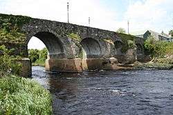 River Derg and the Ardstraw Bridge | |
| Native name | Abhainn na Deirge |
| Etymology | From Lough Derg, 'red lake' |
| Country | Republic of Ireland, Northern Ireland |
| Physical characteristics | |
| Main source |
Lough Derg, County Donegal 138 metres (453 ft) |
| River mouth | North Channel via Lough Foyle, River Foyle, River Mourne |
| Length | 45 kilometres (28 mi) |
| Discharge |
|
| Basin features | |
| Basin size | 440 square kilometres (170 sq mi) |
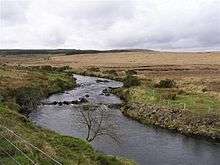
River Derg on the Northern Ireland side of the border
The River Derg is a small river in Ireland. The river has its source in the Lough Derg and it flows to east through Castlederg and join to the River Strule to form the River Mourne. The upper reaches of the catchment are characterised by peatland, while the lower reaches flow predominantly through farmland.[1] The River Derg's length is 28 miles (45 km)[2]
The River Derg is known for its salmon, grilse and sea trout.
See also
References
| Wikimedia Commons has media related to River Derg. |
Coordinates: 54°44′N 7°26′W / 54.733°N 7.433°W
This article is issued from
Wikipedia.
The text is licensed under Creative Commons - Attribution - Sharealike.
Additional terms may apply for the media files.