Ringarooma
| Ringarooma Tasmania | |
|---|---|
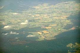 Area surrounding Ringarooma which is right of centre | |
 Ringarooma | |
| Coordinates | 41°14′S 147°40′E / 41.233°S 147.667°ECoordinates: 41°14′S 147°40′E / 41.233°S 147.667°E |
| Population | 338 (2016 census)[1] |
| Established | 1882 |
| Postcode(s) | 7263 |
| Elevation | 283 m (928 ft) |
| Location |
|
| LGA(s) | Dorset Council |
| State electorate(s) | Bass |
| Federal Division(s) | Bass |
Ringarooma is a small town in north-eastern Tasmania. It is located just east of the Ringarooma River and is about 12km south-west from Derby and 55km east-northeast from Launceston. The area around Ringarooma is known for diary farming and timber harvesting.
History
The district was opened up to farming in the 1860s, and the town itself was founded in 1882 when a rural property was subdivided into lots by landowner Christopher Krushka. It was initially known as Krushka Town before being renamed Ringarooma in November 1888, taking on the name of a coastal town near Bridport, which was renamed Boobyalla.[2][3] Ringarooma is believed to be an aboriginal word meaning happy hunting ground.[4]
Ringarooma Post Office opened on 1 October 1874.[5]
In 2017 it was named the Legendary Capital of Tasmania.[6]
Present day
Today, Ringarooma is a small town surrounded by dairy farming and timber harvesting country[4] near mountains such as Mount Victoria and Ben Lomond.
The Mount Victoria Forest Reserve that contains Ralphs Falls[7] and Cash Gorge/Falls[8] is about 15km to the SouthEast of Ringarooma, while the St Columba Falls are a further 10km away (70km by road).[9][10]
Notable people
- Bartlett Adamson, journalist, poet, author and political activist (1884–1951), (born here)[11]
- Alfred Gaby, recipient of the Victoria Cross (1892–1918), (born at Springfield near here)[12]
- Alan Lindsay Wardlaw, pastoralist, soldier and parliamentarian, managed a farm nearby.
References
- ↑ Australian Bureau of Statistics (27 June 2017). "Ringarooma (L) (Urban Centre/Locality)". 2016 Census QuickStats. Retrieved 23 July 2017.

- ↑ Beswick, Dorothy (1988). As The River Flows, Mount Victoria to Boobyalla. Ringarooma Council. ISBN 0-7316-1966-8.
- ↑ "NS2809 - The E R Pretyman Index: NS2809-1–16(Ria - San)". stors.tas.gov.au. Libraries Tasmania. p. 20. Retrieved 26 September 2018.
- 1 2 Alison Andrews (11 March 2009). "Ringarooma: A`happy hunting ground'". The Examiner. Retrieved 26 September 2018.
- ↑ Premier Postal History. "Post Office List". Premier Postal Auctions. Retrieved 16 June 2012.
- ↑ "Industry News: Ringarooma: little town, big heart". The Australian Dairyfarmer. Fairfax Agricultural Media. 24 July 2017. Retrieved 26 September 2018.
- ↑ "Ralphs Falls". parks.tas.gov.au. Parks & Wildlife Service Tasmania. Retrieved 30 September 2018.
- ↑ "Ringarooma, Ralph Falls & Cash's Gorge". northeasttasmania.com.au. North East Tasmania Tourism. Retrieved 30 September 2018.
- ↑ "St. Columba Falls". parks.tas.gov.au. Parks & Wildlife Service Tasmania. Retrieved 30 September 2018.
- ↑ "Ringarooma, Tasmania 7263 Saint Columba Falls State Reserve, Pyengana Tas 7216". google.com. Google. Retrieved 30 September 2018.
- ↑ Robert Darby. "Adamson, George Ernest Bartlett (1884–1951)". adb.anu.edu.au. National Centre of Biography. Retrieved 26 September 2018.
- ↑ D. Elliot. "Gaby, Alfred Edward (1892–1918)". adb.anu.edu.au. National Centre of Biography. Retrieved 26 September 2018.