Ringøy
| Ringøy | |
|---|---|
| Village | |
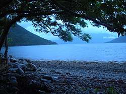 Campsite at Ringøy | |
 Ringøy Location in Hordaland county  Ringøy Ringøy (Norway) | |
| Coordinates: 60°26′28″N 6°46′51″E / 60.44111°N 6.78083°ECoordinates: 60°26′28″N 6°46′51″E / 60.44111°N 6.78083°E | |
| Country | Norway |
| Region | Western Norway |
| County | Hordaland |
| District | Hardanger |
| Municipality | Ullensvang |
| Elevation[1] | 21 m (69 ft) |
| Time zone | UTC+01:00 (CET) |
| • Summer (DST) | UTC+02:00 (CEST) |
Ringøy is a small village in the municipality of Eidfjord in Hordaland county, Norway.[1][2][3]
The settlement lies on the south side of the Eid Fjord, an inner branch of the Hardanger Fjord. The ferry quay at Ringøy served the ferry connection to Ulvik until 1938, when the quay on the south side of the fjord was relocated to Brimnes.[4] Ringøy lies about 10 kilometers (6.2 mi) north of the village of Kinsarvik, the municipal seat, and about 20 kilometers (12 mi) east of Eidfjord in the municipality of Eidfjord.[5]
Norwegian National Road 13 passes through Ringøy.[6] There is a campsite next to the fjord in the village.[7][8]
References
- 1 2 "Ringøy, Ullensvang (Hordaland)" (in Norwegian). yr.no. Retrieved May 17, 2018.
- ↑ "Ringøy Hordaland". NRK. Retrieved May 17, 2018.
- ↑ "Ullensvang". Store norske leksikon. Retrieved May 17, 2018.
- ↑ Hus, Kristian (December 8, 2014). "Fram og tilbake over fjorden". Skintvis: Kvinnherad i ord, bilete og lyd. Retrieved May 17, 2018.
- ↑ "Ringøy". Norgeskart. Retrieved May 17, 2018.
- ↑ Sjåstad, Eivind Dahle (August 18, 2013). "Vi har fått en bro, men tilførselsvegen er ikke godt nok sikret". Hardanger Folkeblad. Retrieved May 17, 2018.
- ↑ Welle-Strand, Erling (1963). Reis rikig i Norge. Oslo: E.G. Mortensen. p. 21.
- ↑ "Ringøy Camping". Retrieved May 17, 2018.
This article is issued from
Wikipedia.
The text is licensed under Creative Commons - Attribution - Sharealike.
Additional terms may apply for the media files.