Richardson Mountains
| Richardson Mountains | |
|---|---|
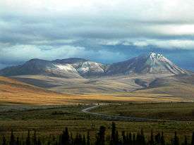 Dempster Highway crossing the Richardson Mountains | |
| Highest point | |
| Elevation | 1,240 m (4,070 ft) [1] |
| Naming | |
| Etymology | Named for Arctic explorer John Richardson[1] |
| Geography | |
| Country | Canada |
| Province | Yukon |
| Range coordinates | 68°10′N 137°00′W / 68.167°N 137.000°WCoordinates: 68°10′N 137°00′W / 68.167°N 137.000°W |
| Parent range | Brooks Range |
The Richardson Mountains are a mountain range located west of the mouth of the Mackenzie River in northern Yukon, Canada. They parallel the northernmost part of the boundary of the Yukon and Northwest Territories.
Although some sources consider the Richardson Mountains to be part of the Canadian Rockies, the common northern limit of the Canadian Rockies is the Liard River, which is a long way south. The Richardson Mountains are a sub-range of the Brooks Range which lies mostly in Alaska.[1]
See also
References
- 1 2 3 "Richardson Mountains". Retrieved Feb 10, 2016.
This article is issued from
Wikipedia.
The text is licensed under Creative Commons - Attribution - Sharealike.
Additional terms may apply for the media files.