Rhyll, Victoria
| Rhyll Victoria | |||||||||||||||
|---|---|---|---|---|---|---|---|---|---|---|---|---|---|---|---|
 Beach Road, Rhyll | |||||||||||||||
 Rhyll | |||||||||||||||
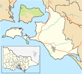
| Coordinates | 38°27′47″S 145°18′14″E / 38.46306°S 145.30389°ECoordinates: 38°27′47″S 145°18′14″E / 38.46306°S 145.30389°E | ||||||||||||||
| Population | 674 (2011 census)[1] | ||||||||||||||
| Postcode(s) | 3923 | ||||||||||||||
| Location | 140 km (87 mi) from Melbourne | ||||||||||||||
| LGA(s) | Bass Coast Shire | ||||||||||||||
| State electorate(s) | Bass | ||||||||||||||
| Federal Division(s) | Flinders | ||||||||||||||
| |||||||||||||||
Rhyll is a small fishing town on Phillip Island in Victoria, Australia. It is located in the north-east corner of the island. It is named after Rhyl, a holiday resort in North Wales, Great Britain. At the 2011 census, Rhyll had a population of 674.
The first European to arrive in the area was George Bass, who landed in 1798 to make repairs to his ship. He returned in the same year with Matthew Flinders and a memorial for this landing is maintained close to Rhyll pier. A temporary British settlement called Flagstaff was established in 1826, and was settled in 1856.
The Post Office opened on 19 September 1889.[2] It operates as a central mail collection point for locals as there is no mail delivery. It is also a General Store.
There is a boat service centre, and a three lane boat ramp which is accessible 24 hours. A daily or annual ramp ticket is required to be displayed in vehicles using the ramp.
The mangrove boardwalk of the Rhyll Inlet is a haven for pelicans, black swans, gulls and straw-necked ibis. The all-tide boat ramp is equipped with barbecues, two playgrounds, tennis courts and public toilets. Rhyll contains a general store, and accommodation includes several B&B's, and a full range of dining is available, from a local tavern and restaurant, to breakfast dining and restaurants with take-away menus, including a fish'n'chip shop.
Climate
Rhyll has an oceanic climate heavily moderated by the surrounding sea, resulting in mild summers with frequent dry spells, and moderately wet and cool winters that remain within 11 °C (20 °F) from summer highs on average.
| Climate data for Rhyll (1991-2017 normals) | |||||||||||||
|---|---|---|---|---|---|---|---|---|---|---|---|---|---|
| Month | Jan | Feb | Mar | Apr | May | Jun | Jul | Aug | Sep | Oct | Nov | Dec | Year |
| Record high °C (°F) | 40.2 (104.4) |
42.1 (107.8) |
36.8 (98.2) |
31.1 (88) |
23.6 (74.5) |
19.7 (67.5) |
19.3 (66.7) |
25.7 (78.3) |
25.1 (77.2) |
30.9 (87.6) |
35.5 (95.9) |
38.2 (100.8) |
42.1 (107.8) |
| Average high °C (°F) | 23.8 (74.8) |
24.3 (75.7) |
22.6 (72.7) |
19.5 (67.1) |
16.3 (61.3) |
13.9 (57) |
13.3 (55.9) |
14.3 (57.7) |
16.1 (61) |
18.0 (64.4) |
20.2 (68.4) |
21.9 (71.4) |
18.7 (65.6) |
| Average low °C (°F) | 15.4 (59.7) |
15.9 (60.6) |
14.7 (58.5) |
12.6 (54.7) |
10.7 (51.3) |
8.9 (48) |
8.1 (46.6) |
8.4 (47.1) |
9.5 (49.1) |
10.6 (51.1) |
12.3 (54.1) |
13.8 (56.8) |
11.7 (53.1) |
| Record low °C (°F) | 1.3 (34.3) |
0.7 (33.3) |
0.8 (33.4) |
0.3 (32.5) |
−1.6 (29.1) |
1.2 (34.2) |
3.4 (38.1) |
1.1 (34) |
−1.4 (29.5) |
0.3 (32.5) |
−0.6 (30.9) |
−1.6 (29.1) |
−1.6 (29.1) |
| Average precipitation mm (inches) | 37.2 (1.465) |
42.2 (1.661) |
39.5 (1.555) |
59.6 (2.346) |
73.2 (2.882) |
63.3 (2.492) |
70.1 (2.76) |
77.8 (3.063) |
68.9 (2.713) |
59.7 (2.35) |
59.1 (2.327) |
45.2 (1.78) |
695.8 (27.394) |
| Average relative humidity (%) | 61 | 60 | 60 | 64 | 70 | 74 | 73 | 68 | 66 | 64 | 61 | 65 | 65 |
| Source: [3] | |||||||||||||
References
- ↑ Australian Bureau of Statistics (31 October 2012). "Rhyll (State Suburb)". 2011 Census QuickStats. Retrieved 2012-10-17.

- ↑ Premier Postal History, Post Office List, retrieved 2008-04-11
- ↑ "Rhyll Climate Observations". Bureau of Meteorology. Retrieved 14 February 2018.