Reksta
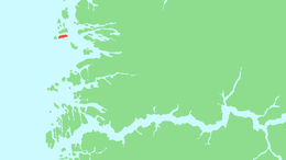 The island of Reksta (in red) shown in relation to Sogn og Fjordane county | |
| Geography | |
|---|---|
| Location | Flora, Norway |
| Coordinates | 61°34′04″N 4°50′05″E / 61.5677°N 4.8346°ECoordinates: 61°34′04″N 4°50′05″E / 61.5677°N 4.8346°E |
| Area | 5.6 km2 (2.2 sq mi) |
| Length | 5.8 km (3.6 mi) |
| Width | 1.5 km (0.93 mi) |
| Coastline | 24 km (14.9 mi) |
| Highest elevation | 220 m (720 ft) |
| Highest point | Harefjellet |
| Administration | |
| County | Sogn og Fjordane |
| Municipality | Flora |
| Demographics | |
| Population | 144 (2001) |
Reksta is an island in the municipality of Flora in Sogn og Fjordane country, Norway. The 5.8-square-kilometre (2.2 sq mi) island lies about 7 kilometres (4.3 mi) west of the town of Florø in a large group of inhabited islands. Reksta sits about 600 metres (2,000 ft) east of the island of Kinn, about 5 kilometres (3.1 mi) north of the island of Askrova, and about 1.4 kilometres (0.87 mi) south of the island of Skorpa. Most of the inhabitants on Reksta live on the west side in and around the small fishing village of Rognaldsvåg. The population of the island (2001) is 144.[1] [2]
References
- ↑ Statistisk sentralbyrå (2001). "Folke- og boligtellingen 2001, kommune- og bydelshefter 1401 Flora" (PDF) (in Norwegian).
- ↑ Store norske leksikon. "Reksta" (in Norwegian). Retrieved 2010-08-07.
This article is issued from
Wikipedia.
The text is licensed under Creative Commons - Attribution - Sharealike.
Additional terms may apply for the media files.