Registrar-General's building
| Registrar-General's building | |
|---|---|
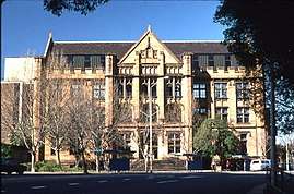 The building, pictured in 2007 | |
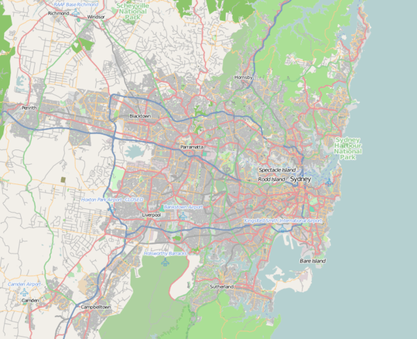 Location in Greater Sydney | |
| Alternative names | Land Titles Office |
| Etymology | Registrar-General Department |
| General information | |
| Status | Complete |
| Type | Government administration |
| Architectural style | Federation Gothic |
| Location | 1 Prince Albert Road, Sydney central business district, New South Wales |
| Country | Australia |
| Coordinates | 33°52′12″S 151°12′48″E / 33.8699106915°S 151.2132561990°ECoordinates: 33°52′12″S 151°12′48″E / 33.8699106915°S 151.2132561990°E |
| Current tenants | Land and Property Information |
| Construction started | 1909 |
| Completed | 1913 |
| Client | Registrar-General's Department |
| Owner | Government of New South Wales |
| Technical details | |
| Material |
|
| Floor count | 3 |
| Design and construction | |
| Architect |
|
| Architecture firm | New South Wales Government Architect |
| Official name | Land Titles Office |
| Designated | 2 April 1999 |
| Reference no. | 00962 |
The Registrar-General's building, also called the Land Titles Office, is an heritage-listed building located in the Sydney central business district, in New South Wales, Australia. The building is currently used by the Land and Property Information division of the Department of Finance, Services and Innovation, part of the Government of New South Wales.
The building is located near the junction of College and Macquarie street and is set in an historical setting on the eastern fringe of the central business district alongside St Mary's Cathedral, Queen's Square, St James' Church,[1] the Sydney Mint,[2][3] the UNESCO World Heritage Listed Hyde Park Barracks, and Hyde Park.
Description
Designed by Walter Liberty Vernon in 1908, the building was constructed in stages from 1909 to 1913 to house the Registrar-General's Department, replacing the 1860 Registrar General's Office in Elizabeth Street. The building was used as the central recording point of births, deaths and marriages in the state and the storage of title deeds for the vast majority of the twentieth century.[4]
On 2 April 1999 the building was listed on the New South Wales State Heritage Register with the following statement of significance:[5][6]
A well scaled civic building sensitively detailed to complement the adjoining older buildings such as St. Mary's Cathedral. Its carefully composed sandstone facade contributes to the streetscape and satisfactorily terminates the northern end of College Street. It provides a sympathetic component in the progression of civic historical buildings along College Street to Queen's Square. The building has long association with the registration of birth, death and marriages, as well as trade marks, bills of sale, business agents etc. The building stores valuable old registers and other land title documents.
— Statement of significance, New South Wales State Heritage Register.
See also
Reference
- ↑ "St. James' Anglican Church". New South Wales State Heritage Register. Office of Environment and Heritage. Retrieved 17 November 2013.
- ↑ "Mint Building". New South Wales State Heritage Register. Office of Environment and Heritage. Retrieved 25 October 2017.
- ↑ "Mint Building and Hyde Park Barracks Group". New South Wales State Heritage Register. Office of Environment and Heritage. Retrieved 25 October 2017.
- ↑ Blair, Peter; Ticehurst, Frank; Baalman, John; Wells, Theodore Le Mare (2015). "Land titles office practice NSW". Sydney: Thomson Reuters (Professional) Australia Limited. Retrieved 27 October 2017.
- ↑ "Land Titles Office". New South Wales State Heritage Register. Office of Environment and Heritage. Retrieved 25 October 2017.
- ↑ "Former Registrar General's Department Building Including Interior". New South Wales State Heritage Register. Office of Environment and Heritage. Retrieved 25 October 2017.
Further reading
- "A Brief History of the Records of the Registrar General" (PDF). Land and Property Information. Government of New South Wales. March 2013. ISSN 2200-9736. Retrieved 27 October 2017.