Regenstauf
| Regenstauf | ||
|---|---|---|
| ||
 Regenstauf Location of Regenstauf within Regensburg district 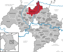 | ||
| Coordinates: 49°07′25″N 12°07′42″E / 49.12361°N 12.12833°ECoordinates: 49°07′25″N 12°07′42″E / 49.12361°N 12.12833°E | ||
| Country | Germany | |
| State | Bavaria | |
| Admin. region | Oberpfalz | |
| District | Regensburg | |
| Government | ||
| • Mayor | Siegfried Böhringer (SPD) | |
| Area | ||
| • Total | 100.00 km2 (38.61 sq mi) | |
| Elevation | 334-580 m (−1,569 ft) | |
| Population (2017-12-31)[1] | ||
| • Total | 16,205 | |
| • Density | 160/km2 (420/sq mi) | |
| Time zone | CET/CEST (UTC+1/+2) | |
| Postal codes | 93128 | |
| Dialling codes | 09402 | |
| Vehicle registration | R | |
| Website | www.regenstauf.de | |

Regenstauf is a municipality in the district of Regensburg, in Bavaria, Germany. It is situated on the river Regen, 12 km north of Regensburg.
References
- ↑ "Fortschreibung des Bevölkerungsstandes". Bayerisches Landesamt für Statistik und Datenverarbeitung (in German). September 2018.
This article is issued from
Wikipedia.
The text is licensed under Creative Commons - Attribution - Sharealike.
Additional terms may apply for the media files.