Redtop, Missouri
| Redtop, Missouri | |
|---|---|
| Unincorporated community | |
 Redtop  Redtop | |
| Coordinates: 37°30′13″N 93°08′39″W / 37.50361°N 93.14417°WCoordinates: 37°30′13″N 93°08′39″W / 37.50361°N 93.14417°W | |
| Country |
United States |
| State | Missouri |
| County | Dallas |
| Township | Jasper |
| Elevation | 371 m (1,217 ft) |
| Time zone | UTC-6 (Central (CST)) |
| • Summer (DST) | UTC-5 (CDT) |
| GNIS feature ID | 737911[1] |
Redtop is an unincorporated community in Dallas County, Missouri.[1] It is located west of U.S. Route 65 (on an older alignment of the highway) approximately 9 mi (14 km) south of Buffalo.
Redtop is part of the Springfield, Missouri Metropolitan Statistical Area.
History
A post office was established in 1889 or earlier, and was named "Cassity" after the postmaster, T.N. Cassity.[1][2] Because the name was similar to "Cassidy", a post office in southern Missouri, the name was changed to "Marmaduke", after Confederate general John S. Marmaduke.[1][2] That name was too long for the postal ring or stamp, and again needed to be changed. Cassity's wife suggested "redtop", which was a type of grass (Agrostis gigantea) which grew in a large field behind the store in which the office was housed, and which had a reddish color when ripe.[2]
The post office was later moved to U.S. Route 65.[2]
References
- 1 2 3 4 U.S. Geological Survey Geographic Names Information System: Redtop
- 1 2 3 4 "Dallas County Place Names, 1928-1945". The State Historical Society of Missouri. Retrieved September 14, 2016.
Municipalities and communities of Dallas County, Missouri, United States | ||
|---|---|---|
| Cities | 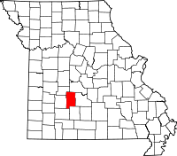 | |
| Village | ||
| Townships | ||
| CDP | ||
| Other unincorporated communities | ||
| Ghost towns | ||
| Footnotes | ‡This populated place also has portions in an adjacent county or counties | |