Ravne, Šoštanj
| Ravne | |
|---|---|
 Ravne Location in Slovenia | |
| Coordinates: 46°24′1.31″N 15°3′44.75″E / 46.4003639°N 15.0624306°ECoordinates: 46°24′1.31″N 15°3′44.75″E / 46.4003639°N 15.0624306°E | |
| Country |
|
| Traditional region | Styria |
| Statistical region | Savinja |
| Municipality | Šoštanj |
| Area | |
| • Total | 14.04 km2 (5.42 sq mi) |
| Elevation | 391.6 m (1,284.8 ft) |
| Population (2002) | |
| • Total | 1,062 |
| [1] | |
Ravne (pronounced [ˈɾaːu̯nɛ], German: Raune[2]) is a settlement in the Municipality of Šoštanj in northern Slovenia. It lies in the Mozirje Hills (Slovene: Mozirske planine) north of the town of Šoštanj. The area is part of the traditional region of Styria. The entire municipality is now included in the Savinja Statistical Region.[3]
The local church is dedicated to the Holy Spirit and belongs to the Parish of Šoštanj. It dates to the second half of the 16th century.[4] The ruins of Forhtenek Castle, a 14th-century castle destroyed in a peasants' revolt in 1635, are still visible on a hill above the settlement.[5]
References
- ↑ Statistical Office of the Republic of Slovenia
- ↑ Leksikon občin kraljestev in dežel zastopanih v državnem zboru, vol. 4: Štajersko. Vienna: C. Kr. Dvorna in Državna Tiskarna. 1904. p. 272.
- ↑ Šoštanj municipal site
- ↑ Slovenian Ministry of Culture register of national heritage reference number ešd 3434
- ↑ Slovenian Ministry of Culture register of national heritage reference number ešd 4334
External links
| Settlements | 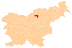 | |
|---|---|---|
| Landmarks |
| |
| Notable people | ||
This article is issued from
Wikipedia.
The text is licensed under Creative Commons - Attribution - Sharealike.
Additional terms may apply for the media files.