Ratanpur, Chhattisgarh
- For namesakes, see Ratanpur (disambiguation)
| Ratanpur | |
|---|---|
| city | |
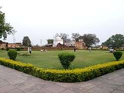 Ratanpur fort | |
 Ratanpur Location in Chhattisgarh, India  Ratanpur Ratanpur (India) | |
| Coordinates: 22°18′N 82°10′E / 22.3°N 82.17°ECoordinates: 22°18′N 82°10′E / 22.3°N 82.17°E | |
| Country |
|
| State | Chhattisgarh |
| District | Bilaspur |
| Elevation | 306 m (1,004 ft) |
| Population (2001) | |
| • Total | 19,838 |
| Languages | |
| • Official | Hindi, Chhattisgarhi |
| Time zone | UTC+5:30 (IST) |
| Vehicle registration | CG |
Ratanpur is a town and a nagar palika in Bilaspur district in the Indian state of Chhattisgarh. It is located about 25 kilometres (16 mi) from Bilaspur on National Highway 200 towards Ambikapur.
History
Ratanpura, originally known as Ratnapura, was the capital of Kalachuris of Ratnapura, who were a branch of the Kalachuris of Tripuri. According to the 1114 CE Ratanpur inscription of the local king Jajjaladeva I, his ancestor Kalingaraja conquered Dakshina Kosala region, and made Tummana (modern Tuman) his capital. Kalingaraja's grandson Ratnaraja established Ratnapura (modern Ratanpur).[1]
In 1407, the Kingdom of Ratanpur was divided into two parts, with its junior branch ruling from Raipur.[2] It continued as the capital of Haihaiyavansi Kingdom until the 18th century, when it ruled large areas of Chhattisgarh, until the area passed to the control of the Bhosle and later the British.[2][3]
Demographics
As of the 2001 India census,[4] Ratanpur had a population of 19,838. Males constituted 51% of the population and females 49%. Ratanpur has an average literacy rate of 59%, lower than the national average of 59.5% while male literacy is 70, and female literacy is 47%. In Ratanpur, 17% of the population is under 6 years of age.
Culture and religion
The town is popular as a religious center and many Hindu devotees come here to offer their prayers and seek the blessings at the Mahamaya Temple, goddess Mahamaya also known as Kosaleswari, as she was presiding deity of Dakshin Kosal (modern Chhattisgarh).
Many other temples such as Bhudha Mahadev and Ramtekri are also situated there.
Transport
At around 25 kilometres (16 mi) from Bilaspur, the second largest town in Chhattisgarh state after Raipur, the journey to Raipur from the town can be made by plane, train or bus.
References
| Wikimedia Commons has media related to Ratanpur, Chhattisgarh. |
- ↑ F. Kielhorn (1888). Rajim stone inscription of Jagapala of the Kulachuri year 896. The Indian Antiquary. p. 138.
- 1 2 Anthropology of ancient Hindu kingdoms: a study in civilizational perspective By Makhan Jha. 1997. p. 65.
- ↑ India and Nepal: sacred centres and anthropological researches By Makhan Jha. 1998. p. 96.
- ↑ "Census of India 2001: Data from the 2001 Census, including cities, villages and towns (Provisional)". Census Commission of India. Archived from the original on 2004-06-16. Retrieved 2008-11-01.