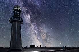
Ras El Bar
| Ras El Bar | |
|---|---|
    | |
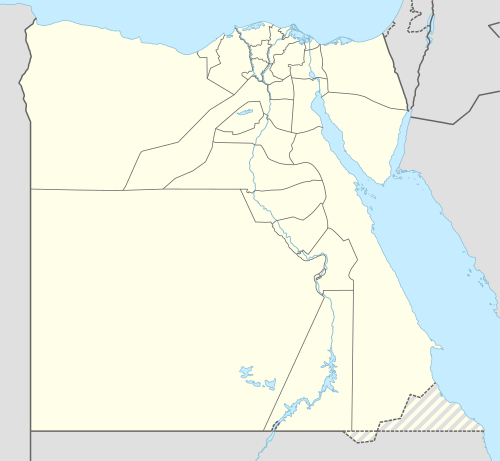 Ras El Bar Location in Egypt | |
| Coordinates: 31°30′45″N 31°49′32″E / 31.51250°N 31.82556°ECoordinates: 31°30′45″N 31°49′32″E / 31.51250°N 31.82556°E | |
| Country |
|
| Governorate | Damietta |
| Population | |
| • Total | 250,000 |
| Time zone | UTC+2 (EST) |
| Website | www.raselbar.com/ |
Ras El Bar (Egyptian Arabic: راس البر Rās el-Barr , IPA: [ɾɑːs elˈbɑɾ]), which means "head of land", is a resort city in the Governorate of Damietta, in northeast Egypt. It is located at Mediterranean Sea, at the mouth of the Damietta river, a distributary of the Nile, opposite Izbat al-Burj. There are approximately 25,000 permanent residents in the city. However, during the summer peak holiday season, from July to September, the population quickly expands to over 250,000.
Geography
Location
Ras El Bar lies in a peninsula on the coast of the Mediterranean Sea, and it is bordered on the western by the Damietta Nile branch. The area of "Lessan" is located in the extreme northern part of this peninsula, and it is at this point where the Damietta Nile arm flows in the Mediterranean sea, which gives Ras El Bar the shape of a triangle.
Climate
The climate of Ras El Bar is very similar to that of Damietta, owing to its proximity, and contains a high percentage of iodine. Its climate is classified as hot desert (BWh) by Köppen-Geiger system.
Port Said, Kosseir, Ras El Bar, Baltim, Damietta and Alexandria have the least temperature variation in Egypt.
| Climate data for Ras El Bar | |||||||||||||
|---|---|---|---|---|---|---|---|---|---|---|---|---|---|
| Month | Jan | Feb | Mar | Apr | May | Jun | Jul | Aug | Sep | Oct | Nov | Dec | Year |
| Average high °C (°F) | 17.1 (62.8) |
18.0 (64.4) |
19.7 (67.5) |
22.9 (73.2) |
26.9 (80.4) |
28.6 (83.5) |
29.8 (85.6) |
30.1 (86.2) |
28.6 (83.5) |
27.1 (80.8) |
23.7 (74.7) |
19.2 (66.6) |
24.3 (75.8) |
| Daily mean °C (°F) | 13.3 (55.9) |
13.9 (57) |
15.5 (59.9) |
18.3 (64.9) |
22.1 (71.8) |
24.3 (75.7) |
26.0 (78.8) |
26.3 (79.3) |
24.7 (76.5) |
23.3 (73.9) |
19.8 (67.6) |
15.4 (59.7) |
20.2 (68.4) |
| Average low °C (°F) | 9.5 (49.1) |
9.9 (49.8) |
11.3 (52.3) |
13.8 (56.8) |
17.3 (63.1) |
20.0 (68) |
22.3 (72.1) |
22.6 (72.7) |
20.9 (69.6) |
19.5 (67.1) |
16.0 (60.8) |
11.6 (52.9) |
16.2 (61.2) |
| Average precipitation mm (inches) | 30 (1.18) |
22 (0.87) |
15 (0.59) |
4 (0.16) |
2 (0.08) |
0 (0) |
0 (0) |
0 (0) |
0 (0) |
8 (0.31) |
17 (0.67) |
28 (1.1) |
126 (4.96) |
| Source: Climate-Data.org[1] | |||||||||||||
Another source with stabler and hotter averages.
| Climate data for Ras El Bar | |||||||||||||
|---|---|---|---|---|---|---|---|---|---|---|---|---|---|
| Month | Jan | Feb | Mar | Apr | May | Jun | Jul | Aug | Sep | Oct | Nov | Dec | Year |
| Average high °C (°F) | 18.7 (65.7) |
19.2 (66.6) |
21.0 (69.8) |
23.3 (73.9) |
25.8 (78.4) |
29.0 (84.2) |
31.3 (88.3) |
31.6 (88.9) |
30.2 (86.4) |
27.6 (81.7) |
24.4 (75.9) |
20.4 (68.7) |
25.2 (77.4) |
| Average low °C (°F) | 11.7 (53.1) |
12.1 (53.8) |
14.3 (57.7) |
16.6 (61.9) |
19.6 (67.3) |
22.8 (73) |
24.7 (76.5) |
25.4 (77.7) |
24.3 (75.7) |
21.9 (71.4) |
18.2 (64.8) |
13.9 (57) |
18.8 (65.8) |
| Average rainy days | 3 | 3 | 2 | 1 | 0 | 0 | 0 | 0 | 0 | 1 | 1 | 2 | 13 |
| Source: Storm247[2] | |||||||||||||
Shores
The uniqueness of Ras El Bar as one of the world's rare points where a river meets the sea has offered it a great advantage which is having shores that overlook both the Nile and sea. It's even said that Ras El Bar existence is a result of that unique meeting as both the sea and the Nile left sand and alluvium.
Nature
Type of sand
For Ras El Bar to be a sandy beach instead of an alluvial farming land like the rest of the delta takes us back to ancient prehistoric ages. Initially, the Mediterranean Sea covered the whole delta, and then it began to fall back and the river deluged over the delta and covered the lower areas with alluvium. When it comes to Ras El Bar the sands of the sea played a main role in turning the spot into a sandy beach instead of normal muddy farming land. These sands are believed to have great medical benefits especially in noon times.
Animals and Plants
- Many dolphins visit Ras El Bar shores
- Many kinds of wild birds actually live in the Manzala lake
- Also in the fall season many of the immigrating flocks of European birds pass by Ras El Bar in her course to South Africa
Infrastructure
Houses
The land renting system started back since 1898, then started building houses and villas that were named "e'sha" (hut). In 1902, the first civic time for that town was implemented, and it was considered that the streets are straight and parallels to maintain the town’s beauty. At the very beginning those huts were built of wood and other simple materials, had only one floor and hosted only one family. Actually they were built at the start of the summer and removed at its end. Nowadays, Damiettans preserved the design of the town and the spaces between every villa and the other. They built new villas using cement and bricks. Now single blocks have twelve units most of them with a garage. They are still named "e'sha" (hut) among locals, but in reality they follow the structure of a villa.
Roads
Inner:
- Port Said Street: is the main access in Ras El-Bar and it connects its entrance to the beginning of "Lesan".
- Nile Street: more like a shopping centre full of shops and hotels, and it exactly parallel to the Nile.
External:
- Older roads that links Ras El-Bar with other governorates are available all year long.
Sports
- There are many kinds of sport like Beach sports; swimming competitions which involve crossing the nile from Damietta to Ras El Bar.
- Many clubs and gyms for sports like football, volleyball, handball, cong fu, karate, judo, etc.
Health
There are three main hospitals located in Ras El Bar: 1. "El Yoom El Wahed" (the sole day) 2. "Ras El Bar El Markazy" (central Ras El Bar) 3. "Da'wet El Hakk": which is a smaller one but offers a variety of medical services. There are also many small medical centres that deal with beach injuries.
Education
Ras El Bar as a summer resort has a small number of settled families all year long, therefore one finds lesser number of schools and universities.
Economy
Since early ages, Ras El Bar has been a main port for all kinds of goods that pass through the Nile and/or come from the sea.
Fishing
Ras El Bar is a huge centre for fishing boats that leave into the Mediterranean sea and returns loaded with different kinds of fish that helped in enriching this industry all over the country. It is also a spot for manufacturing ships of all kinds and sizes especially fishing ones.
Maritime transport and trade
Ras El Bar is closed the main port of Damietta, which handles international trade.
History
Pharaohs
Ras El Bar has been called many names since the Pharaos. Pharos called it the Mediterranean Sea (the great green sea), then came the Romans and called it "The Romans Sea" on 30 AD, and the spot where sea could meet a river was called (Be Tamosh) and it meant the place between two waves or two seas. The name itself Ras El Bar came from some sailors who felt that this place can be the shelter from the sea’s dangers. "Ras" is the start and "El Bar" is the land so it is the start of land and the shelter of any sailor. This place was mentioned in the Quran for three times only to stress out the mighty power of god that made both river and sea meet with a separator that can never be seen and stops them from blending.
Greek and Roman eras
Damietta was known as "Tamiats" during the Greek and Roman eras, and it was known as "Tamiat" during the time of Veterans Copts.
Islamic era
According to the Historical Documents, "Tamiats" was an important Coptic Bishopric during the Fifth Century. The name "Demt", which means "the ability" in the Syriac Language, was also mentioned in a verse sent to the Prophet "Idris" or "Herms". The sense behind the name is the ability that combined the fresh water and the brine water together in that place.
After the revealing of the Quran and before the Islamic conquest of Egypt, it was mentioned that Omar Ibn Al-Khattab recalled Prophet Muhammad's words as follows "Omar, you will open two ports in Egypt, Alexandria and Damietta. About Alexandria, it was destroyed by barbarians. About Damietta, its people are martyrs. This who does this for a night will be with me along with the other Prophets at Al Kuds".
According to Anas ibn Malik, who was one of the Prophet Muhammad's companions, the Prophet Muhammad said "Muslims will open a port that is considered the "ability" place, in which the olds of my 'Ummah' will live; a one night in this place is better than a thousand months worship; it is the "ability" place for those who sacrifice their souls for God." Then, Anas said "and what is that "ability" place, Prophet?" The Prophet Muhammad said "It is the place that is spelled with D, M, and T."
Damietta is called Caphtor by several ancient manuscripts including the Bible, Koran, Josephues, and Egyptian texts. The Torah may use the spelling "Kaftor". Being mentioned and described in the three Holy Heavenly religions is a great pride that Damietta has out of many beautiful places [3]
Crusades
Damietta' position on the west bank of the Nile river is a strategic location that urged many enemies' fleets to conquer the city, and that also urged its people to build a number of fortifying castles and towers to protect the city.
In 1218, The Crusaders started to approach Damietta, and they made a dike surrounded by a bailey to protect them, and they settled there where they initiated their assaults against the strong resistance from the Dumyaty people. The resistance stilled strong for four months, but the Crusaders condensed their attacks and they surrounded the whole city abandoning it and its people from any coming support. However, the Dumyaty people stand strong and kept resisting till the summer season came, and the flood filled the Nile river with water till the baileys were destroyed, and the dike became like an island surrounded with water. After that, the Crusaders were seeking a conciliating treaty to get out of the city and the whole country. After thirty years, the Crusaders came back to conquer Egypt as a starting point for invading Palestine and the other Arab countries.
In 1248, the king of France at that time, Louis IX, sailed from southern France with a great fleet until he reached Damietta's beaches. At that time, the Prince Fakhr El Din left the city with no army and ran away. However, the Dumyaty people resisted that fleet. They burnt their shops and everything that the enemy could make use of, and they retreated to the jungles and the inner places in the city to inveigle the enemy. Then, they started their enchorial stood out and they beaten the French in a number of battles. The last battle was at Faraskour, which is a city on the Nile River, where Dumyaty people killed a number of ten thousand men from the French, and they captivated the others along with the king Louis IX, and they imprisoned him. Later on, King Louis IX paid four thousand Egyptian Pounds to be released along with his men, and he left the Damietta on May 8, 1250, and that date became the National Day of Damietta later on.
The battle was known as Mansoura battle it took place at the recent mansoura city on the Nile river and the king of France at that time was imprisoned at Dar Ibn Lokman.
Modern era
Damietta started to create a new path towards peace and safe life after struggling against invaders. The new path is representing its natural rule that it was created for, which is tourism.
Ras el-Bar is noted as the destination of the celebrated Druze Princess, songstress and film actress Asmahaan (real name, Amaal al-Atrash, q.v.), still revered by many as the greatest Arabic-music singer ever, when she was killed in a car crash in nearby Mansoura, Egypt in July 1944. The two-door car in which she was being chauffeured in the back seat with a female companion went out of control and crashed into a roadside canal there, drowning her and the companion, though the driver managed to escape, giving rise to multiple conspiracy theories as to the cause of the fatality, based on antagonism towards Asmahaan on the part of both the British and Germans during WWII, on the part of Egyptians, Druze and her own family members, including her ex-husband, because of her behavior that they saw as scandalous and dishonorable, and on the part of her great rival the singer Umm Kulthuwm out of jealousy, all which theories are mere speculation, as no evidence of any of them has ever been found.
Recently, an alleyway by the side of the Nile River was made at the city of Ras El Bar. The other side of the alleyway contains a number of shops and restaurants till it reaches the area of "El Lesan". "El Lesan" is the place where the Mediterranean Sea meets the Nile River, and it was also developed to compete with worldwide tourist places.
See also
References
- ↑ "Climate: Ras al Barr - Climate graph, Temperature graph, Climate table". Climate-Data.org. Archived from the original on 2 January 2014. Retrieved 18 August 2013.
- ↑ "Weather for Ras el Bar, Egypt - Climate - Storm247.com". Storm247. Archived from the original on 18 August 2013. Retrieved 18 August 2013.
- ↑ "Ras El Bar in Brief", Mubarak Public Library (Damietta branch)