Raoul, Georgia
| Raoul, Georgia | |
|---|---|
| Census-designated place | |
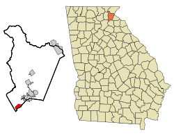 Location in Habersham County and the state of Georgia | |
| Coordinates: 34°26′59″N 83°36′12″W / 34.44972°N 83.60333°WCoordinates: 34°26′59″N 83°36′12″W / 34.44972°N 83.60333°W | |
| Country | United States |
| State | Georgia |
| County | Habersham |
| Area | |
| • Total | 2.02 sq mi (5.22 km2) |
| • Land | 2.01 sq mi (5.20 km2) |
| • Water | 0.008 sq mi (0.02 km2) |
| Elevation | 1,421 ft (433 m) |
| Population (2010) | |
| • Total | 2,558 |
| • Density | 1,274/sq mi (491.8/km2) |
| Time zone | UTC-5 (Eastern (EST)) |
| • Summer (DST) | UTC-4 (EDT) |
| FIPS code | 13-63588[1] |
| GNIS feature ID | 0351437[2] |
Raoul is a census-designated place (CDP) in Habersham County, Georgia, United States. As of the 2010 census, the CDP had a population of 2,558,[3] up from 1,816 at the 2000 census.
Geography
Raoul is located in the southwest corner of Habersham County at 34°26′59″N 83°36′12″W / 34.44972°N 83.60333°W (34.449668, -83.603337).[4] It is bordered to the northeast by the town of Alto and to the southeast by Banks County. Georgia State Route 13 (Gainesville Highway) forms the Banks County line at Raoul, and four-lane U.S. Route 23 (Tommy Irwin Parkway) forms the northwest edge of the community. Cornelia is 6 miles (10 km) to the northeast, and Gainesville is 18 miles (29 km) to the southwest.
According to the United States Census Bureau, the Raoul CDP has a total area of 2.0 square miles (5.2 km2), of which 0.01 square miles (0.02 km2), or 0.33%, are water.[3]
Demographics
As of the census[1] of 2010, there were 2,558 people, 348 households, and 262 families residing in the CDP. The population density was 1266.3 people per square mile (490/km²). There were 405 housing units at an average density of 200.5/sq mi (77.6/km²). The racial makeup of the CDP was 66.8% White, 24.6% African American, 0.4% Native American, 0.7% Asian, 6.0% from other races, and 1.4% from two or more races. Hispanic or Latino of any race were 10.2% of the population.
There were 405 households out of which 35.6% had children under the age of 18 living with them, 54.3% were married couples living together, 14.4% had a female householder with no husband present, and 24.7% were non-families. 20.1% of all households were made up of individuals and 6.3% had someone living alone who was 65 years of age or older. The average household size was 2.91 and the average family size was 3.36.
In the CDP, the population was spread out with 13.1% under the age of 20, 8.83% from 20 to 24, 49.2% from 25 to 44, 24.5% from 45 to 64, and 4.3% who were 65 years of age or older. The median age was 36.1 years. Females made up 80.6% of the population, and 86.9% of the population from ages 20 to 64 were female.
As of the 2000 census, $35,192, and the median income for a family was $36,538. Males had a median income of $25,313 versus $18,750 for females. The per capita income for the CDP was $6,871. About 14.4% of families and 18.7% of the population were below the poverty line, including 25.3% of those under age 18 and 15.8% of those age 65 or over.
References
- 1 2 "American FactFinder". United States Census Bureau. Retrieved 2008-01-31.
- ↑ "US Board on Geographic Names". United States Geological Survey. 2007-10-25. Retrieved 2008-01-31.
- 1 2 "Geographic Identifiers: 2010 Demographic Profile Data (G001): Raoul CDP, Georgia". American Factfinder. U.S. Census Bureau. Retrieved May 16, 2017.
- ↑ "US Gazetteer files: 2010, 2000, and 1990". United States Census Bureau. 2011-02-12. Retrieved 2011-04-23.
Municipalities and communities of Habersham County, Georgia, United States | ||
|---|---|---|
| Cities | 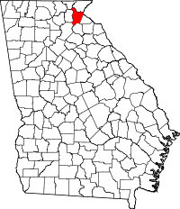 | |
| Towns | ||
| CDP | ||
| Unincorporated communities | ||
| Footnotes | ‡This populated place also has portions in an adjacent county or counties | |