Rani Village
| Rani Village | |
|---|---|
| Village | |
| Village of East Siang | |
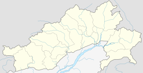 Rani Village Location in Arunachal Pradesh, India  Rani Village Rani Village (India) | |
| Coordinates: 27°58′N 95°19′E / 27.96°N 95.31°ECoordinates: 27°58′N 95°19′E / 27.96°N 95.31°E | |
| Country |
|
| State | Arunachal Pradesh |
| District | East Siang |
| Circle | Sille-Oyan |
| Founded | 1949 |
| Government | |
| • Type | ZPM, MLA, MP |
| • ZPM | Tajing Taki (INC) |
| • MLA | Tatung Jamoh & Tangor Tapak |
| • MP | Ninong Ering & Tapir Gao |
| Elevation | 4 m (14 ft) |
| Population (Census 2011) | |
| • Total | 1,924 |
| • Rank | 3rd in East Siang District |
| As on Census 2011 | |
| Time zone | IST (UTC+5:30) |
| STD | 791102 |
| Area code(s) | 0368 |
| Students' Union Name | All Rani Students' Union (ARSU) |
| Website |
www |
Rani Village or Rani is a small village located in the Sille-Oyan circle of East Siang district, Arunachal Pradesh with a total of 924 residing families. It is situated 12 km from the district headquarter Pasighat and the 3rd largest village in the East Siang district, after Riga Village and Mirem Village.[1][2][3]
History
The name Rani is assumed to be derived from an archaeological site at Gomsi, where there might have resided a "Rani" (queen) during the medieval period (Probably of the Chutiya Kingdom). The site was excavated from an cultivation field of Rani Village. As per the Archaeological Survey of India it is assumed that the Rani of the Chutiya kingdom was residing there.[4]
Climate
| Climate data for Rani Village | |||||||||||||
|---|---|---|---|---|---|---|---|---|---|---|---|---|---|
| Month | Jan | Feb | Mar | Apr | May | Jun | Jul | Aug | Sep | Oct | Nov | Dec | Year |
| Average high °C (°F) | 26.5 (79.7) |
28.5 (83.3) |
31.7 (89.1) |
33.0 (91.4) |
35.1 (95.2) |
36.6 (97.9) |
36.6 (97.9) |
36.5 (97.7) |
36.0 (96.8) |
33.5 (92.3) |
31.0 (87.8) |
27.5 (81.5) |
32.7 (90.9) |
| Average low °C (°F) | 9.3 (48.7) |
10.7 (51.3) |
13.5 (56.3) |
15.7 (60.3) |
18.3 (64.9) |
21.3 (70.3) |
21.7 (71.1) |
21.9 (71.4) |
20.9 (69.6) |
17.3 (63.1) |
14.1 (57.4) |
10.7 (51.3) |
16.3 (61.3) |
| Average rainfall mm (inches) | 42.8 (1.685) |
96.1 (3.783) |
144.6 (5.693) |
259.5 (10.217) |
371.0 (14.606) |
847.8 (33.378) |
1,081.1 (42.563) |
670.6 (26.402) |
583.7 (22.98) |
231.7 (9.122) |
29.1 (1.146) |
30.3 (1.193) |
4,388.3 (172.768) |
| Average rainy days | 3.7 | 7.0 | 10.2 | 13.0 | 13.8 | 19.0 | 22.0 | 15.5 | 15.0 | 7.6 | 2.1 | 2.2 | 131.1 |
| Source: India Meteorological Department | |||||||||||||
Geographical location
It is located 12 km from Pasighat and 20 km from Ruksin.[5]
Places adjacent to Rani Village | ||||||||||
|---|---|---|---|---|---|---|---|---|---|---|
| ||||||||||
References
- ↑ "Villages in Sille-Oyan Circle". One Five Nine. 16 May 2014.
- ↑ Rani-i- Sille, Rani-ii- Sille, Rani-iii- Sille, Rani-iv- Sille. "Rani Village". Soki.in. Retrieved 24 November 2014.
- ↑ Ering, Ninong. "Ering Visit Rani Village". North East India News. Retrieved 25 November 2014.
- ↑ "Villages in Sille-Oyan Circle". One Five Nine. 1 June 2010.
- ↑ Rani, Village. "Rani village location and map". Retrieved 24 November 2014.
See also
Further reading
- "Rani Population - East Siang, Arunachal Pradesh". Census 2011. 26 December 2011.
- Indian Archaeology 1996-1997[1]
| Wikimedia Commons has media related to Rani Village. |
- ↑ Menan, Gupta. Archaelogical Survey of India (PDF). Archaelogical Survey of India. Retrieved 25 November 2014.
This article is issued from
Wikipedia.
The text is licensed under Creative Commons - Attribution - Sharealike.
Additional terms may apply for the media files.