Transport in Suriname
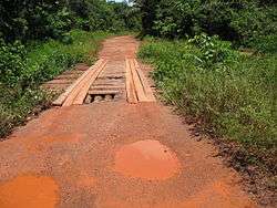
Primary road between Paramaribo and Brownsweg.
The Republic of Suriname (Dutch: Republiek Suriname) has a number of forms of transport.
Railways
- Railways, total: 166 km single track.
- standard gauge: 80 km 1,435 mm (4 ft 8 1⁄2 in) gauge in West-Suriname, but not in use. This stretch was constructed as part of the West Suriname Plan.
- narrow gauge: 86 km 1,000 mm (3 ft 3 3⁄8 in) gauge Lawa Railway from Onverdacht to Brownsberg, currently not in use but a plan has been announced to reopen the line between Onverwacht and Paramaribo Central Station. The completion date for phase one was hoped to be 2016 and the intention is for the line to be extended onto Paramaribo Adolf Pengel Airport.
Rail links with adjacent countries
- None
Highways
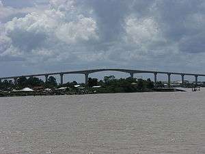
The Coppename Bridge over the Coppename River near Boskamp.

- total: 4,304 km
- paved: 1,130 km
- unpaved: 3,174 km (2003)
NOTE: Driving is on the left. Suriname and its neighbour Guyana are the only two countries on the (in-land) American continent which still drive on the left.
Road links with adjacent countries


Waterways
1,200 km; most important means of transport; oceangoing vessels with drafts ranging up to 7 m can navigate many of the principal waterways.
Ports and harbours
- Albina
- Moengo
- Nieuw-Nickerie
- Paramaribo
- Paranam
- Wageningen
Merchant marine
- total: 3 ships (1,000 gross register tons (GRT) or over) totaling 3,432 GRT/4,525 tonnes deadweight (DWT)
- ships by type: (1999 est.)
Airports
- 55 (2013)
- List of airports in Suriname
Paved runways
- total: 6
- over 3,047 m: 1
- under 914 m: 5 (2013)
Unpaved runways
- total: 49
- 914 to 1,523 m: 4
- under 914 m: 45 (2013)
See also
References
- cia.gov, CIA World Factbook,7 January 2014
External links
![]()
Transport in the Americas | ||
|---|---|---|
| ||
| Sovereign states |
| .svg.png) |
| ||
This article is issued from
Wikipedia.
The text is licensed under Creative Commons - Attribution - Sharealike.
Additional terms may apply for the media files.