Jules Wijdenbosch Bridge
| Jules Wijdenbosch Bridge | |
|---|---|
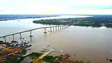 The Jules Wijdenbosch Bridge on the mouth of the Suriname river in Paramaribo | |
| Coordinates | 5°48′20″N 55°09′45″W / 5.80556°N 55.1625°WCoordinates: 5°48′20″N 55°09′45″W / 5.80556°N 55.1625°W |
| Carries | 2-lane wide highway (East-West Link) |
| Crosses | Suriname river |
| Locale | North Suriname |
| Other name(s) | Suriname Bridge |
| Characteristics | |
| Total length | 1,504 metres (4,934 ft) |
| Longest span | 155 metres (509 ft) |
| History | |
| Opened | 20 May 2000 |
 Jules Wijdenbosch Bridge Location in Paramaribo | |
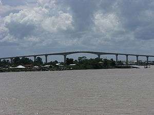
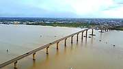
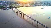
The Jules Wijdenbosch Bridge (Dutch: Jules Wijdenboschbrug), also called Suriname bridge and known locally as Bosje Brug, is a bridge over the Suriname River between the capital city Paramaribo and Meerzorg in the Commewijne District. The bridge is part of the East-West Link, and is named after former president Jules Wijdenbosch. Constructed by Dutch constructor Ballast-Nedam, the bridge has two lanes, is 1504 metres long, and was opened on 20 May 2000.
Gallery

The bridge from the air.
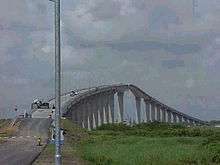
The bridge from the road.
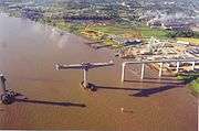
Under construction (1999).

Propaganda advertisement.

See also
| Wikimedia Commons has media related to Jules Wijdenbosch Bridge. |
References
External links
This article is issued from
Wikipedia.
The text is licensed under Creative Commons - Attribution - Sharealike.
Additional terms may apply for the media files.