Ragley, Louisiana
| Ragley, Louisiana | |
|---|---|
| Unincorporated community | |
 Ragley, Louisiana  Ragley, Louisiana | |
| Coordinates: 30°30′46″N 93°13′57″W / 30.51278°N 93.23250°WCoordinates: 30°30′46″N 93°13′57″W / 30.51278°N 93.23250°W | |
| Country | United States |
| State | Louisiana |
| Parish | Beauregard |
| Elevation | 92 ft (28 m) |
| Population (2014) | |
| • Total | 4,630 |
| Time zone | UTC-6 (Central (CST)) |
| • Summer (DST) | UTC-5 (CDT) |
| ZIP code | 70657 |
| Area code(s) | 337 |
| GNIS feature ID | 555751[1] |
Ragley is an unincorporated community in Beauregard Parish, Louisiana, United States. The community is located at the junction of U.S. routes 171 and 190, 20 miles (32 km) north of Lake Charles. Ragley has a post office with ZIP code 70657.[2][3]
References
- ↑ "Ragley". Geographic Names Information System. United States Geological Survey.
- ↑ United States Postal Service. "USPS - Look Up a ZIP Code". Retrieved February 19, 2015.
- ↑ "Postmaster Finder - Post Offices by ZIP Code". United States Postal Service. Retrieved February 19, 2015.
Municipalities and communities of Beauregard Parish, Louisiana, United States | ||
|---|---|---|
| Cities | 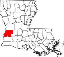 | |
| Towns | ||
| CDPs | ||
| Other unincorporated communities | ||
| Ghost town | ||
| Footnotes | ‡This populated place also has portions in an adjacent parish or parishes | |
This article is issued from
Wikipedia.
The text is licensed under Creative Commons - Attribution - Sharealike.
Additional terms may apply for the media files.