Radlin, Silesian Voivodeship
| Radlin | ||
|---|---|---|
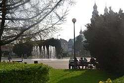 Central square in Radlin | ||
| ||
 Radlin | ||
| Coordinates: 50°1′0″N 18°29′0″E / 50.01667°N 18.48333°E | ||
| Country | Poland | |
| Voivodeship | Silesian | |
| County | Wodzisław | |
| Gmina | Radlin (urban gmina) | |
| First mentioned | 1365 | |
| Government | ||
| • Mayor | Barbara Magiera | |
| Area | ||
| • Total | 12.53 km2 (4.84 sq mi) | |
| Highest elevation | 298 m (978 ft) | |
| Lowest elevation | 245 m (804 ft) | |
| Population (2006) | ||
| • Total | 17,673 | |
| • Density | 1,400/km2 (3,700/sq mi) | |
| Time zone | UTC+1 (CET) | |
| • Summer (DST) | UTC+2 (CEST) | |
| Postal code | 44-310 | |
| Car plates | SWD | |
| Website | http://www.radlin.pl | |

Radlin [ˈradlʲin] is a town in Wodzisław County, Silesian Voivodeship, Poland, with 17,656 inhabitants (2006). Located in southern part of the Voivodeship, close to the Czech border, between 1975 and 1997,[1] Radlin was a district of the city of Wodzisław Śląski.
First mention of the settlement of Biertułtowy (which now makes the center of Radlin) comes from 1305, as Bertholdi villa. The very name Radlin probably comes from the Polish word radło, which means ard. In the 19th century, Radlin was one of the biggest villages of the Rybnik County of the Kingdom of Prussia. Like other locations of Upper Silesia, it grew in the 19th century, when several enterprises were opened there - Coal Mine Marcel, Coke Plant Radlin. In 1922, after Silesian Uprisings, it became part of Poland.
Among most famous people associated with Radlin are Leszek Blanik and Bolesław Kominek.
Sport
- Górnik Radlin - men's volleyball team playing in Polish Volleyball League (Polska Liga Siatkówki, PLS: Seria B in 2003/2004, Seria A in 2004/2005 season).
Tourism
- Graduation Tower in Radlin - first graduation tower on an industrial side of Upper Silesia in Poland [2]
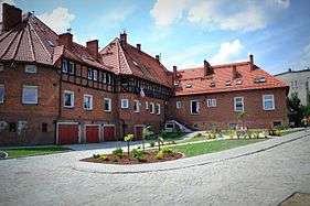
- Kolonia Emma in Radlin - modernist estate of the nineteenth century designed as a "garden city"[3]
References
- ↑ "Radlin.pl / Historia". miasto.radlin.pl (in Polish). Retrieved 2017-02-07.
- ↑ "Tężnia solankowa w Radlinie". www.teznia.radlin.pl (in Polish). Retrieved 2017-02-10.
- ↑ "Kolonia Emma w Radlinie". Kolonia Emma w Radlinie (in Polish). Retrieved 2017-02-10.
External links
| Urban gminas |
|  |
|---|---|---|
| Rural gminas | ||
| Wikimedia Commons has media related to Radlin. |
Coordinates: 50°02′N 18°29′E / 50.033°N 18.483°E