RNAS Donibristle
| RNAS Donibristle (HMS Merlin) RAF Donibristle | |||||||||||||||||||
|---|---|---|---|---|---|---|---|---|---|---|---|---|---|---|---|---|---|---|---|
| Summary | |||||||||||||||||||
| Airport type | Military | ||||||||||||||||||
| Owner | Air Ministry | ||||||||||||||||||
| Operator |
Royal Navy Royal Air Force | ||||||||||||||||||
| Location | Donibristle, Fife | ||||||||||||||||||
| Built | 1916 | ||||||||||||||||||
| In use | 1917-1959 | ||||||||||||||||||
| Elevation AMSL | 128 ft / 39 m | ||||||||||||||||||
| Coordinates | 56°02′27″N 003°20′57″W / 56.04083°N 3.34917°WCoordinates: 56°02′27″N 003°20′57″W / 56.04083°N 3.34917°W | ||||||||||||||||||
| Map | |||||||||||||||||||
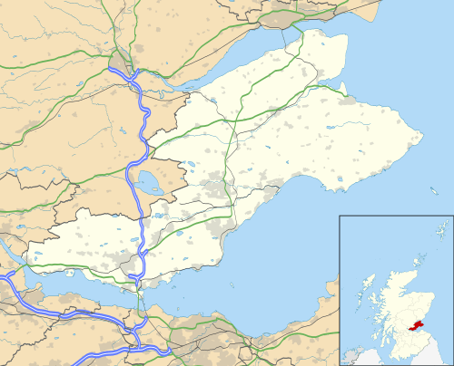 RNAY Donibristle Location in Fife | |||||||||||||||||||
| Runways | |||||||||||||||||||
| |||||||||||||||||||
RNAS Donibristle is a former Fleet Air Arm base located 2.7 miles (4.3 km) east of Rosyth, Fife, Scotland and 8.7 miles (14.0 km) northwest of Edinburgh, Lothian.
From 1918 to 1939 the station was called RAF Donibristle.
History
 |
| Her Majesty's Naval Service of the British Armed Forces |
|---|
| Components |
|
|
| History and future |
|
|
| Ships |
| Personnel |
| Auxiliary services |
The following units were posted here at some point:
- No. 22 Squadron RAF.[1]
- No. 36 Squadron RAF.[2]
- No. 42 Squadron RAF.[3]
- No. 77 Squadron RAF.[4]
- No. 100 Squadron RAF.[5]
- No. 271 Squadron RAF.[6]
- No. 2 Anti-Aircraft Co-operation Unit 'D' Flight.[4]
- No. 16 GP Practice Flight.[4]
- No. 18 (Reconnaissance) Group.[4]
- No. 29 (Fleet) Group.[4]
- 700 Naval Air Squadron.[4]
- 701 Naval Air Squadron.[4]
- 739 Naval Air Squadron.[4]
- 758 Naval Air Squadron.[4]
- 767 Naval Air Squadron.[4]
- 769 Naval Air Squadron.[4]
- 770 Naval Air Squadron.[4]
- 771 Naval Air Squadron.[4]
- 780 Naval Air Squadron.[4]
- 782 Naval Air Squadron.[4]
- 784 Naval Air Squadron.[4]
- 800 Naval Air Squadron.[4]
- 801 Naval Air Squadron.[4]
- 802 Naval Air Squadron.[4]
- 803 Naval Air Squadron.[4]
- 804 Naval Air Squadron.[4]
- 805 Naval Air Squadron.[4]
- 806 Naval Air Squadron.[4]
- 807 Naval Air Squadron.[4]
- 808 Naval Air Squadron.[4]
- 810 Naval Air Squadron.[4]
- 811 Naval Air Squadron.[4]
- 812 Naval Air Squadron.[4]
- 813 Naval Air Squadron.[4]
- 814 Naval Air Squadron.[4]
- 816 Naval Air Squadron.[4]
- 817 Naval Air Squadron.[4]
- 819 Naval Air Squadron.[4]
- 820 Naval Air Squadron.[4]
- 821 Naval Air Squadron.[4]
- 822 Naval Air Squadron.[4]
- 823 Naval Air Squadron.[4]
- 824 Naval Air Squadron.[4]
- 825 Naval Air Squadron.[4]
- 827 Naval Air Squadron.[4]
- 828 Naval Air Squadron.[4]
- 830 Naval Air Squadron.[4]
- 860 Naval Air Squadron.[4]
- 881 Naval Air Squadron.[4]
- 882 Naval Air Squadron.[4]
- 884 Naval Air Squadron.[4]
- 886 Naval Air Squadron.[4]
- 888 Naval Air Squadron.[4]
- 890 Naval Air Squadron.[4]
- 891 Naval Air Squadron.[4]
- 892 Naval Air Squadron.[4]
- 893 Naval Air Squadron.[4]
- 1770 Naval Air Squadron.[4]
- 1820 Naval Air Squadron.[4]
- 1830 Naval Air Squadron.[4]
- 1830A Naval Air Squadron.[4]
- 1841 Naval Air Squadron.[4]
- 1842 Naval Air Squadron.[4]
- Aircraft Repair Depot.[4]
- Coastal Area Aircraft Depot.[4]
- Fleet Aircraft Acceptance Depot.[4]
- Fleet Aircraft Repair Depot.[4]
- Northern Communications Squadron.[4]
- Torpedo Training Flight.[4]
Current use
The site is now a combination of Donibristle Industrial Park and Hillend Industrial Park.[4]
See also
References
Citations
- ↑ Jefford 1988, p. 32.
- ↑ Jefford 1988, p. 37.
- ↑ Jefford 1988, p. 39.
- 1 2 3 4 5 6 7 8 9 10 11 12 13 14 15 16 17 18 19 20 21 22 23 24 25 26 27 28 29 30 31 32 33 34 35 36 37 38 39 40 41 42 43 44 45 46 47 48 49 50 51 52 53 54 55 56 57 58 59 60 61 62 63 64 65 "Donibristle". Airfields of Britain Conservation Trust. Retrieved 22 October 2013.
- ↑ Jefford 1988, p. 54.
- ↑ Jefford 1988, p. 82.
Bibliography
- Jefford MBE, Wg Cdr C G (1988). RAF Squadrons. A comprehensive record of the movement and equipment of all RAF squadrons and their antecedents since 1912. Shrewsbury: Airlife. ISBN 1-85310-053-6.
Royal Air Force portal | ||
| Formations and units |  | |
| Branches and components | ||
| Reserve forces | ||
| Associated civil organisations | ||
| Equipment | ||
| Personnel | ||
| Appointments | ||
| Symbols and uniform | ||
This article is issued from
Wikipedia.
The text is licensed under Creative Commons - Attribution - Sharealike.
Additional terms may apply for the media files.