RAF Alness
| RAF Alness | |||||||||||||||||||
|---|---|---|---|---|---|---|---|---|---|---|---|---|---|---|---|---|---|---|---|
| Summary | |||||||||||||||||||
| Airport type | Military | ||||||||||||||||||
| Owner | Air Ministry | ||||||||||||||||||
| Operator | Royal Air Force | ||||||||||||||||||
| Location | Alness, Ross and Cromarty | ||||||||||||||||||
| Built | 1920 | ||||||||||||||||||
| In use | 1920-1986 | ||||||||||||||||||
| Elevation AMSL | 13 ft / 4 m | ||||||||||||||||||
| Coordinates | 57°40′54″N 004°15′46″W / 57.68167°N 4.26278°WCoordinates: 57°40′54″N 004°15′46″W / 57.68167°N 4.26278°W | ||||||||||||||||||
| Map | |||||||||||||||||||
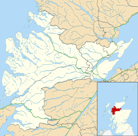 RAF Alness Location in Ross and Cromarty | |||||||||||||||||||
| Runways | |||||||||||||||||||
| |||||||||||||||||||
RAF Alness is a former Royal Air Force station located 1.1 miles (1.8 km) southwest of Alness, Ross and Cromarty, Scotland and 14.1 miles (22.7 km) north of Inverness, Inverness-shire.
History
RAF Alness was previously called RAF Invergordon until 10 February 1943.[1]
The following units were based here at some point:
- No. 201 Squadron RAF.[2]
- No. 209 Squadron RAF.[3]
- No. 210 Squadron RAF.[3]
- No. 228 Squadron RAF.[4]
- No. 240 Squadron RAF.[5]
- No. 4 (Coastal) Operational Training Unit RAF.[6]
- No. 5 Flying Boat Servicing Unit.[6]
- No. 6 Air/Sea Rescue Marine Craft Unit.[6]
- No. 302 Ferry Training Unit.[6]
- No. 1100 Marine Craft Unit.[6]
- Coastal Command Flying Instructors School.[6]
- Flying Boat Development Flight.[6]
- Seaplane Training Squadron.[6]
Current use
The site is now Alness Point Business Park.[6]
See also
References
Citations
- ↑ Jefford 1988, p. 147.
- ↑ Jefford 1988, p. 67.
- 1 2 Jefford 1988, p. 70.
- ↑ Jefford 1988, p. 74.
- ↑ Jefford 1988, p. 76.
- 1 2 3 4 5 6 7 8 9 "Alness (Invergordon)". Airfields of Britain Conservation Trust. Retrieved 22 October 2013.
Bibliography
- Jefford MBE, Wg Cdr C G (1988). RAF Squadrons. A comprehensive record of the movement and equipment of all RAF squadrons and their antecedents since 1912. Shrewsbury: Airlife. ISBN 1-85310-053-6.
External links
Royal Air Force portal | ||
| Formations and units |  | |
| Branches and components | ||
| Reserve forces | ||
| Associated civil organisations | ||
| Equipment | ||
| Personnel | ||
| Appointments | ||
| Symbols and uniform | ||
This article is issued from
Wikipedia.
The text is licensed under Creative Commons - Attribution - Sharealike.
Additional terms may apply for the media files.