Rŭngrado
| Rŭngrado | |
| Chosŏn'gŭl |
릉라도 능라도 |
|---|---|
| Hancha | 綾羅島 |
| Revised Romanization |
Reungrado Neungnado |
| McCune–Reischauer |
Rŭngrado Nŭngnado |
 | |
 | |
| Geography | |
|---|---|
| Coordinates | 39°02′40″N 125°46′10″E / 39.04444°N 125.76944°ECoordinates: 39°02′40″N 125°46′10″E / 39.04444°N 125.76944°E |
| Area | 1.3 km2 (0.50 sq mi) |
| Administration | |
|
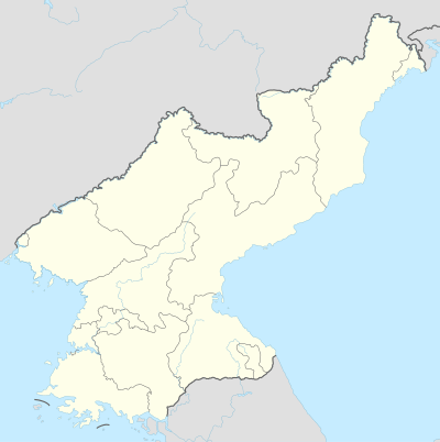
North Korea | |
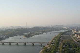
Rungra Islet is an islet in Pyongyang, North Korea, located in the middle of the Taedong River. Its total area is 1.3 square kilometres (0.50 sq mi). The Chongryu Bridge on the north side and the Rungra Bridge on the south side connect the islet to the rest of Pyongyang.[1] The islet is a good place to see some of the Eight Views of Pyongyang.[2]
Recreational facilities on the islet include the Rungrado 1st of May Stadium. The Rungra People's Pleasure Ground is also scheduled to be opened there in 2012; it includes a dolphin exhibit, volleyball and basketball courts, and a wading pool.[3]
References
- ↑ "Picturesque Islet", Korean Central News Agency, 2002-05-09, archived from the original on 2011-06-09, retrieved 2010-06-02
- ↑ "Rŭngrado". Doopedia (in Korean). Retrieved 2018-05-05.
- ↑ "Kim Jong Un Visits Rungna People's Pleasure Ground", Korean Central News Agency, 2012-07-24, retrieved 2012-07-26
This article is issued from
Wikipedia.
The text is licensed under Creative Commons - Attribution - Sharealike.
Additional terms may apply for the media files.