Røstlandet
| Røstlandet | |
|---|---|
| Village / Island | |
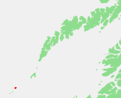 Location of the island in Nordland | |
| Coordinates: 67°31′27″N 12°06′54″E / 67.52417°N 12.11500°ECoordinates: 67°31′27″N 12°06′54″E / 67.52417°N 12.11500°E | |
| Country | Norway |
| Region | Northern Norway |
| County | Nordland |
| District | Lofoten |
| Municipality | Røst |
| Area[1] | |
| • Total | 0.57 km2 (0.22 sq mi) |
| Elevation[2] | 3 m (10 ft) |
| Population (2013)[1] | |
| • Total | 391 |
| • Density | 686/km2 (1,780/sq mi) |
| Time zone | UTC+01:00 (CET) |
| • Summer (DST) | UTC+02:00 (CEST) |
| Post Code | 8064 Røstlandet |
Røstlandet is an island and the administrative centre of the municipality of Røst in Nordland county, Norway. The 3.6-square-kilometre (1.4 sq mi) island is the home to most of the residents of Røst.
Røstlandet is a fishing village covering the southeastern part of the island. Røst Airport is located on the northern part of the island. Røst Church is located in the village and serves the people of Røst.
The highest point on the island is 11 metres (36 ft) above sea level. The 0.57-square-kilometre (140-acre) village has a population (2013) of 391. The population density of the village is 686 inhabitants per square kilometre (1,780/sq mi).[1]
Skomvær Lighthouse is located about 15 kilometres (9.3 mi) southwest of the village.
References
- 1 2 3 Statistisk sentralbyrå (1 January 2013). "Urban settlements. Population and area, by municipality".
- ↑ "Røstlandet" (in Norwegian). yr.no. Retrieved 2012-03-02.
This article is issued from
Wikipedia.
The text is licensed under Creative Commons - Attribution - Sharealike.
Additional terms may apply for the media files.