Pylesville, Maryland
| Pylesville, Maryland | |
|---|---|
| Census-designated place | |
 Pylesville  Pylesville | |
| Coordinates: 39°41′22″N 76°22′24″W / 39.68944°N 76.37333°WCoordinates: 39°41′22″N 76°22′24″W / 39.68944°N 76.37333°W | |
| Country | United States |
| State | Maryland |
| County | Harford |
| Area | |
| • Total | 4.75 sq mi (12.30 km2) |
| • Land | 4.74 sq mi (12.28 km2) |
| • Water | 0.008 sq mi (0.02 km2) |
| Elevation | 358 ft (109 m) |
| Population (2010) | |
| • Total | 693 |
| • Density | 146/sq mi (56.4/km2) |
| Time zone | UTC−5 (Eastern (EST)) |
| • Summer (DST) | UTC−4 (EDT) |
| FIPS code | 24-64375 |
| GNIS feature ID | 0591085 |
Pylesville is an unincorporated community and census-designated place (CDP) in Harford County, Maryland, United States. The population was 693 at the 2010 census.[1] It is part of the Baltimore metropolitan area. Until 1958, this community was served by the Maryland and Pennsylvania Railroad at milepost 40.3.
Geography
Pylesville is in northern Harford County and straddles Broad Creek, an east-flowing tributary of the Susquehanna River. Maryland Route 165 runs through the town, leading northeast 3 miles (5 km) to the Pennsylvania border near Cardiff and southwest 9 miles (14 km) to Jarrettsville. Maryland Route 543 leaves MD 165 just south of the town center, leading south 9 miles (14 km) to Hickory. Bel Air, the Harford County seat, is 12 miles (19 km) to the south via MD 543 and U.S. Route 1 Business.
According to the U.S. Census Bureau, the Pylesville CDP has a total area of 4.7 square miles (12.3 km2), of which 0.01 square miles (0.02 km2), or 0.14%, are water.[1] The CDP extends west from the original settlement of Pylesville as far as Maryland Route 24 (St. Clair Bridge Road).
Education
The Harford County Public School System serves Pylesville. Students in the area attend the Tri-school community of North Harford Elementary, High, and Middle schools, all located in the western part of the CDP, along with students form Jarrettsville, Forest Hill, Bel Air, Darlington, Whiteford, Street/Pylesville, Highland, and Norrisville.
Notable people
- Thomas Wagoner, politician in Alaska
References
- 1 2 "Geographic Identifiers: 2010 Demographic Profile Data (G001): Pylesville CDP, Maryland". American Factfinder. U.S. Census Bureau. Retrieved August 1, 2017.
Municipalities and communities of Harford County, Maryland, United States | ||
|---|---|---|
| Cities | 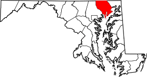 | |
| Town | ||
| CDPs | ||
| Other communities | ||