B26 (New York City bus)
b26 | |||
|---|---|---|---|
| Fulton Street Line | |||
|
| |||
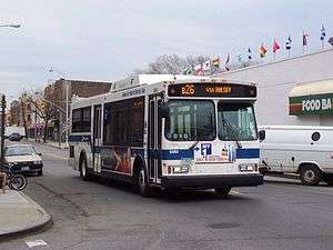 A bus on the B26 line arrives at the Ridgewood terminal. | |||
| Overview | |||
| System | MTA New York City Bus | ||
| Operator | New York City Transit Authority | ||
| Garage | Fresh Pond Depot | ||
| Route | |||
| Locale | Brooklyn | ||
| Start | Downtown Brooklyn – Cadman Plaza West and Tillary Street | ||
| Via | Fulton Street, Halsey Street[1] | ||
| End | Ridgewood, Queens – Wyckoff Avenue and Palmetto Street | ||
| Length | 6.3 miles (10.1 km)[2] | ||
| Service | |||
| Operates | All times[1] | ||
| Annual patronage | 2,920,409 (2017)[3] | ||
| Fare | $2.75 (MetroCard or coins) | ||
| Cash | Coins only (exact change required) | ||
| Transfers | Yes | ||
| Timetable | B26 | ||
| |||
The Putnam Avenue Line is a public transit line in Brooklyn, New York City, United States, running mostly along Fulton Street, Putnam Avenue, and Halsey Street between downtown Brooklyn and Ridgewood, Queens. Originally a streetcar line, it is now the B26 Halsey/Fulton Streets bus route, operated by the New York City Transit Authority.
Route description
The B26 bus route begins at the Jay Street–Borough Hall subway station in Downtown Brooklyn. It heads east on Fulton Street, turning off onto Putnam Avenue, and uses Nostrand Avenue (eastbound) and Bedford Avenue (westbound) to reach Halsey Street. Just shy of the Queens line, the route turns northwest on Wyckoff Avenue, ending with a loop at the Myrtle–Wyckoff Avenues subway station counterclockwise via Putnam Avenue, Myrtle Avenue, and Wyckoff Avenue. Along the way, passengers can transfer to the subway at DeKalb Avenue, Clinton–Washington Avenues, and Halsey Street.
History
The Brooklyn City Rail Road opened a branch of their Fulton Street Line along Putnam Avenue, Nostrand Avenue, and Halsey Street to Broadway by 1874.[4] By 1897, cars could also use a short spur along Howard Avenue from Halsey Street north to Broadway.[5] The line was extended northeast past Broadway on Halsey Street to the Queens County line and northwest on Wyckoff Avenue to Ridgewood after 1897.
Putnam Avenue horse cars were replaced with electric trolleys on July 17, 1893.[6]
Buses were substituted for streetcars on September 21, 1941, but the line was converted back to streetcars between November 29, 1942 and February 5, 1950.[7]
References
- 1 2 MTA Regional Bus Operations. "B26 bus schedule" (PDF).
- ↑ "Downtown Brooklyn Surface Transit Circulation Study" (PDF). 2009. Retrieved July 13, 2018.
- ↑ "Facts and Figures". mta.info. August 28, 2011. Retrieved July 13, 2018.
- ↑ J.B. Beers and Company, Brooklyn, 1874 (with Brooklyn City Rail Road lines overprinted)
- ↑ Rand McNally, Brooklyn and vicinity, 1897 Atlas of the World
- ↑ "How the New Tax is Levied". Brooklyn Daily Eagle. July 17, 1893. p. 10.
- ↑ "New Bus Line in Brooklyn" (PDF). The New York Times. February 5, 1950. Retrieved November 7, 2016.
