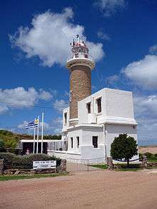
Punta Brava Lighthouse
 Punta Brava Lighthouse | |
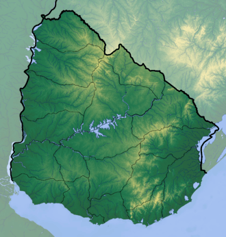 Uruguay | |
| Location |
Punta Brava Montevideo Uruguay |
|---|---|
| Coordinates | 34°56′07″S 56°09′38″W / 34.935311°S 56.160579°WCoordinates: 34°56′07″S 56°09′38″W / 34.935311°S 56.160579°W |
| Year first constructed | 1876 |
| Automated | 1962 |
| Construction | brick tower |
| Tower shape | cylindrical tower with balcony and lantern atop keeper’s house |
| Markings / pattern | unpainted tower, white lantern with red vertical stripes |
| Height | 19 metres (62 ft) |
| Focal height | 21 metres (69 ft) |
| Light source | mains power |
| Range | 15 nautical miles (28 km; 17 mi) |
| Characteristic | Fl WR 5s. |
| Admiralty number | G0700 |
| NGA number | 19124 |
| ARLHS number | URU-012 |
| Uruguay number | UY-151[1] |
Punta Brava Lighthouse (Faro de Punta Brava), also known as Punta Carretas Lighthouse, is a lighthouse in Punta Carretas, Montevideo, Uruguay. It was erected in 1876. The lighthouse has a height of 21 metres and its light reaches 15 miles away, with a flash every ten seconds.[2] In 1962, the lighthouse became electric. The lighthouse is important for guiding boats into the Banco Inglés, Buceo Port or the entrance of the Santa Lucía River, west of Montevideo city.
See also
References
- ↑ Punta Brava The Lighthouse Directory. University of North Carolina at Chapel Hill. Retrieved 6 July 2016
- ↑ "Our Neighborhood" (PDF). Hotel Caladivolpe. Archived from the original (PDF) on 30 April 2011. Retrieved 19 November 2010.
| Wikimedia Commons has media related to Faro de Punta Brava. |
This article is issued from
Wikipedia.
The text is licensed under Creative Commons - Attribution - Sharealike.
Additional terms may apply for the media files.