Pukhrayan
| Pokhrayan Pukharayan | |
|---|---|
| town | |
 Pokhrayan Location in Uttar Pradesh, India | |
| Coordinates: 26°14′N 79°51′E / 26.23°N 79.85°ECoordinates: 26°14′N 79°51′E / 26.23°N 79.85°E | |
| Country |
|
| State | Uttar Pradesh |
| District | Kanpur Dehat |
| Government | |
| • Type | state |
| • Body | Municipality |
| Area | |
| • Total | 24 km2 (9 sq mi) |
| Population (2001) | |
| • Total | 19,908 |
| • Density | 830/km2 (2,100/sq mi) |
| Languages | |
| • Official | Hindi |
| Time zone | UTC+5:30 (IST) |
| PIN | 209111 |
| Telephone code | 05113 |
| Vehicle registration | UP 77 |
Pukhrayan is a town and a Municipality in Kanpur Dehat district in the Indian state of Uttar Pradesh. Found to the south-west of Mati on National Highway 25, Pukhrayan is 4 km from Bhognipur.[1]
Geography
Pukhrayan is located at 26°14′N 79°51′E / 26.23°N 79.85°E.[2] It is on average elevation of 124 metres (405 feet)from sea level. It is 22 km from (District Headquarters) Mati. Holy river Yamuna is near about 15 km south of the city.
Transport
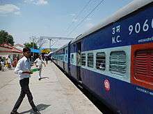
Rail
Pokhrayan is main railway station of Kanpur Dehat districton Kanpur -Jhansi railway section under North Central Railway zone in Jhansi Division.
Stopage of main trains List :
Pokhrayan (PHN) to Kanpur Central (CNB) All Type of Trains Time Table :-
.jpg)
Pokhrayan (PHN) to Jhansi Junction (JHS) All Type of Trains Time Table :-
.jpg)
Road
Lucknow-Jhansi National High Way passes through Pukhrayan city.
Demographics
As of 2001 India census,[3] Pukhrayan had a population of 65,503. Males constitute 53% of the population and females 47%. Pukhrayan has an average literacy rate of 80%, higher than the national average of 59.5%: male literacy is 80%, and female literacy is 70%. In Pukhrayan, 15% of the population is under 6 years of age.
Education
- RSGU Post Graduate College Pukhrayan
- Government Girls Inter College (GGIC)
- Ram Swaroop Gramudyog Inter College
- Vivekanand Rashtriya Inter College
- Prema Katiyar Shikshan Sansthan
- Shivmati Shivnandan Shukla Mahavidyalaya
- National Inter College
- Indian Public School
Religious places
- Mauhar Devi Temple
- Shiv Mandir Sukhai Talab
- Vignharta Ganesh Mandir
- Bade Maha Dev Mandir
- Sant Sua Baba Mandir
- Shani Dev Mandir
- Shri Hanumaan Mandir Nagar Palika Road
- sadhu baba ki gaddi village chauki in pukhrayan kanpur dehat managed by kunwar Pal singh yadav
References
- ↑ "Pukhrayan in India". India9.com. 5 December 2005. Retrieved 8 July 2009.
- ↑
- ↑ "Census of India 2001: Data from the 2001 Census, including cities, villages and towns (Provisional)". Census Commission of India. Archived from the original on 2004-06-16. Retrieved 2008-11-01.